
48 Bus Route Map
View the 48 route map and see all 48 stops along the route. The map of 48 shows where the bus travels and the location of each stop, making it easy to understand the entire route at a glance.
Explore Nateev Express routes on the map and see where Nateev Express bus services operate. Use the 48 map to find bus stops and see how the 48 connects different areas along its trip.
All 48 stops on the map are displayed in route order, helping you follow the 48 bus from the first stop to the last.
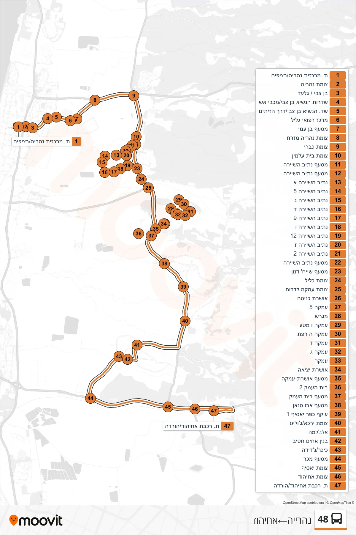
Stops list (48 - Nahariya→Ahihud)
- Nahariya Central Station/Platforms
- Nahariya Junction
- Ben Zvi/Gilad
- President Ben Zvi Boulevard/Fire Station
- President Ben Zvi Boulevard/HaZeitim Road
- Galilee Medical Center
- Ben Ami Junction
- Nahariya East Junction
- Kabri Junction
- Cemetery Junction
- Netiv HaShayara Junction
- Netiv HaShayara Junction
- Netiv HaShayara A
- Netiv HaShayara 5
- Netiv HaShayara C
- Netiv HaShayara D
- Netiv HaShayara 9
- Netiv HaShayara F
- Nativ HaShayara 12
- Netiv HaShayara G
- Netiv HaShayara 2
- Netiv HaShayara Junction
- Masaf Sheikh Danun
- Klil Junction
- Amka Junction South
- Oshrat Entrance
- Amka 5
- Field
- Amka and Mata
- Amka H Dairy Farm
- Amka D
- Amka C
- Amka
- Oshrat Exit
- Oshrat-Amka Junction
- Beit HaEmek 2
- Beit HaEmek Junction
- Abu Sinan Junction
- Kafr Yasif Bypass 1
- Yarka/Julis Junction
- Al-Jalama
- Hatib Brothers Building
- Square/Jadeida
- Maker Junction
- Yasif Junction
- Ahihud Junction
- Ahihud Railway Station/Drop Off