
48 Bus Route Map
View the 48 route map and see all 48 stops along the route. The map of 48 shows where the bus travels and the location of each stop, making it easy to understand the entire route at a glance.
Explore The S routes on the map and see where The S bus services operate. Use the 48 map to find bus stops and see how the 48 connects different areas along its trip.
All 48 stops on the map are displayed in route order, helping you follow the 48 bus from the first stop to the last.
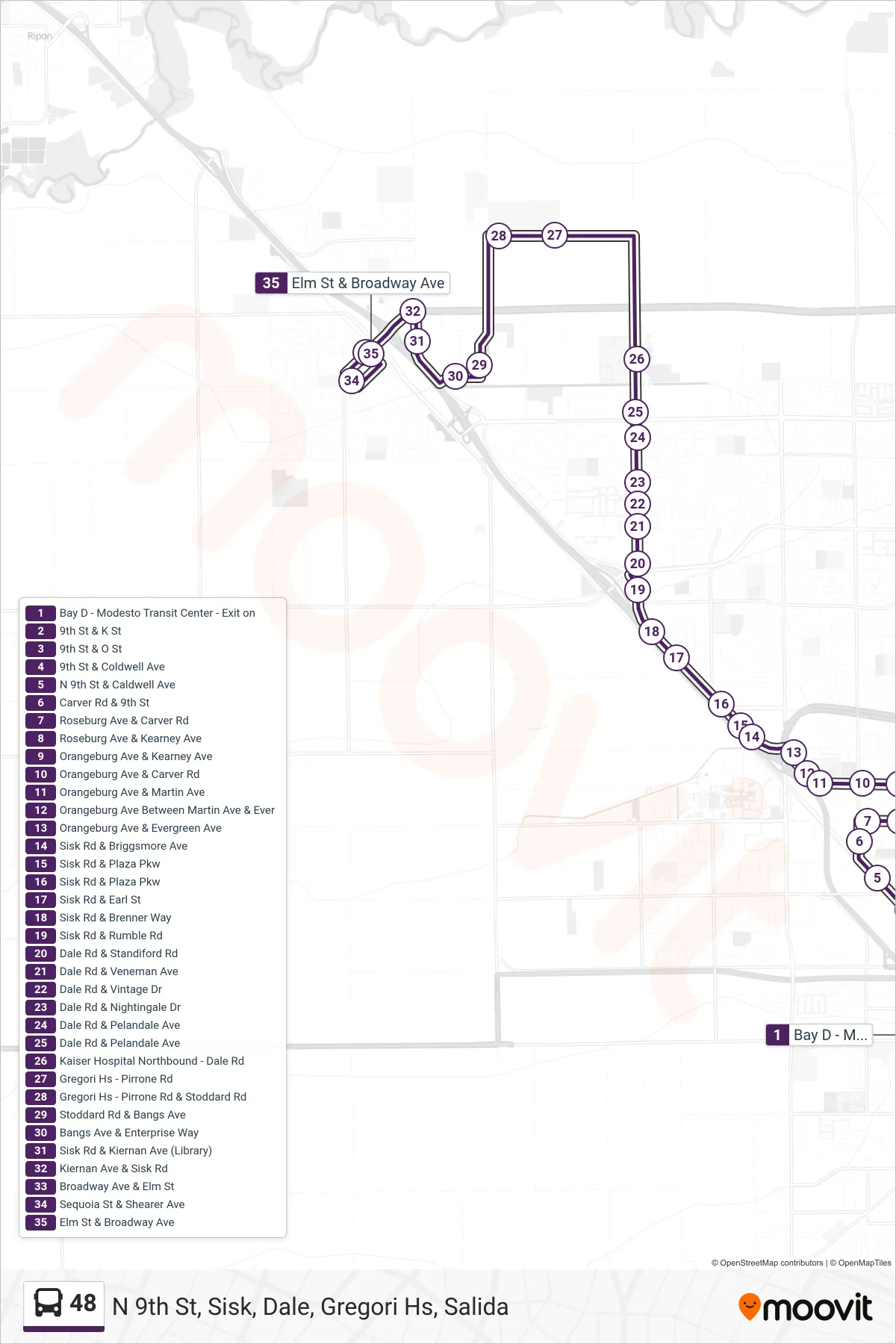
Stops list (48 - N 9th St, Sisk, Dale, Gregori Hs, Salida)
- Bay D - Modesto Transit Center - Exit on
- 9th St & K St
- 9th St & O St
- 9th St & Coldwell Ave
- N 9th St & Caldwell Ave
- Carver Rd & 9th St
- Roseburg Ave & Carver Rd
- Roseburg Ave & Kearney Ave
- Orangeburg Ave & Kearney Ave
- Orangeburg Ave & Carver Rd
- Orangeburg Ave & Martin Ave
- Orangeburg Ave Between Martin Ave & Ever
- Orangeburg Ave & Evergreen Ave
- Sisk Rd & Briggsmore Ave
- Sisk Rd & Plaza Pkw
- Sisk Rd & Plaza Pkw
- Sisk Rd & Earl St
- Sisk Rd & Brenner Way
- Sisk Rd & Rumble Rd
- Dale Rd & Standiford Rd
- Dale Rd & Veneman Ave
- Dale Rd & Vintage Dr
- Dale Rd & Nightingale Dr
- Dale Rd & Pelandale Ave
- Dale Rd & Pelandale Ave
- Kaiser Hospital Northbound - Dale Rd
- Gregori Hs - Pirrone Rd
- Gregori Hs - Pirrone Rd & Stoddard Rd
- Stoddard Rd & Bangs Ave
- Bangs Ave & Enterprise Way
- Sisk Rd & Kiernan Ave (Library)
- Kiernan Ave & Sisk Rd
- Broadway Ave & Elm St
- Sequoia St & Shearer Ave
- Elm St & Broadway Ave