
481 Bus Route Map
View the 481 route map and see all 481 stops along the route. The map of 481 shows where the bus travels and the location of each stop, making it easy to understand the entire route at a glance.
Explore N-Bus GmbH routes on the map and see where N-Bus GmbH bus services operate. Use the 481 map to find bus stops and see how the 481 connects different areas along its trip.
All 481 stops on the map are displayed in route order, helping you follow the 481 bus from the first stop to the last.
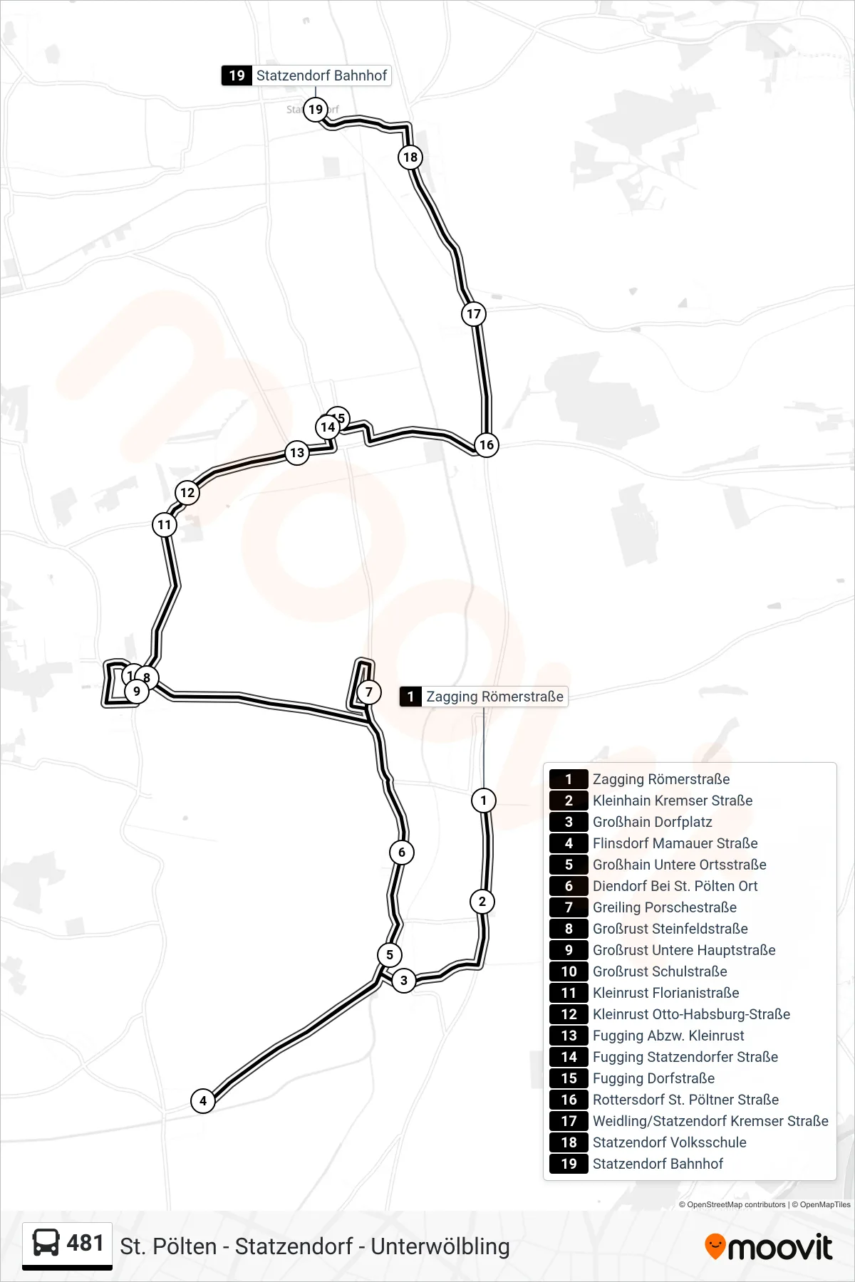
Stops list (481 - Statzendorf Bahnhof)
- Zagging Römerstraße
- Kleinhain Kremser Straße
- Großhain Dorfplatz
- Flinsdorf Mamauer Straße
- Großhain Untere Ortsstraße
- Diendorf Bei St. Pölten Ort
- Greiling Porschestraße
- Großrust Steinfeldstraße
- Großrust Untere Hauptstraße
- Großrust Schulstraße
- Kleinrust Florianistraße
- Kleinrust Otto-Habsburg-Straße
- Fugging Abzw. Kleinrust
- Fugging Statzendorfer Straße
- Fugging Dorfstraße
- Rottersdorf St. Pöltner Straße
- Weidling/Statzendorf Kremser Straße
- Statzendorf Volksschule
- Statzendorf Bahnhof
Change direction
- Route Map - 481 - St. Pölten Hauptbahnhof
- Route Map - 481 - Viehofen Schulen
- Route Map - 481 - Kleinhain Kremser Straße
- Route Map - 481 - Großrust Schulstraße
- Route Map - 481 - Kuffern Untere Ortsstraße
- Route Map - 481 - St. Pölten Prandtauerhalle
- Route Map - 481 - Unterwölbling Ost
- Route Map - 481 - St. Pölten Gymnasium
- Route Map - 481 - St. Pölten Hauptbahnhof
- Route Map - 481 - Statzendorf Bahnhof
- Route Map - 481 - Weitern/St. Pölten West