
482 Bus Route Map
View the 482 route map and see all 482 stops along the route. The map of 482 shows where the bus travels and the location of each stop, making it easy to understand the entire route at a glance.
Explore ww mobility GmbH routes on the map and see where ww mobility GmbH bus services operate. Use the 482 map to find bus stops and see how the 482 connects different areas along its trip.
All 482 stops on the map are displayed in route order, helping you follow the 482 bus from the first stop to the last.
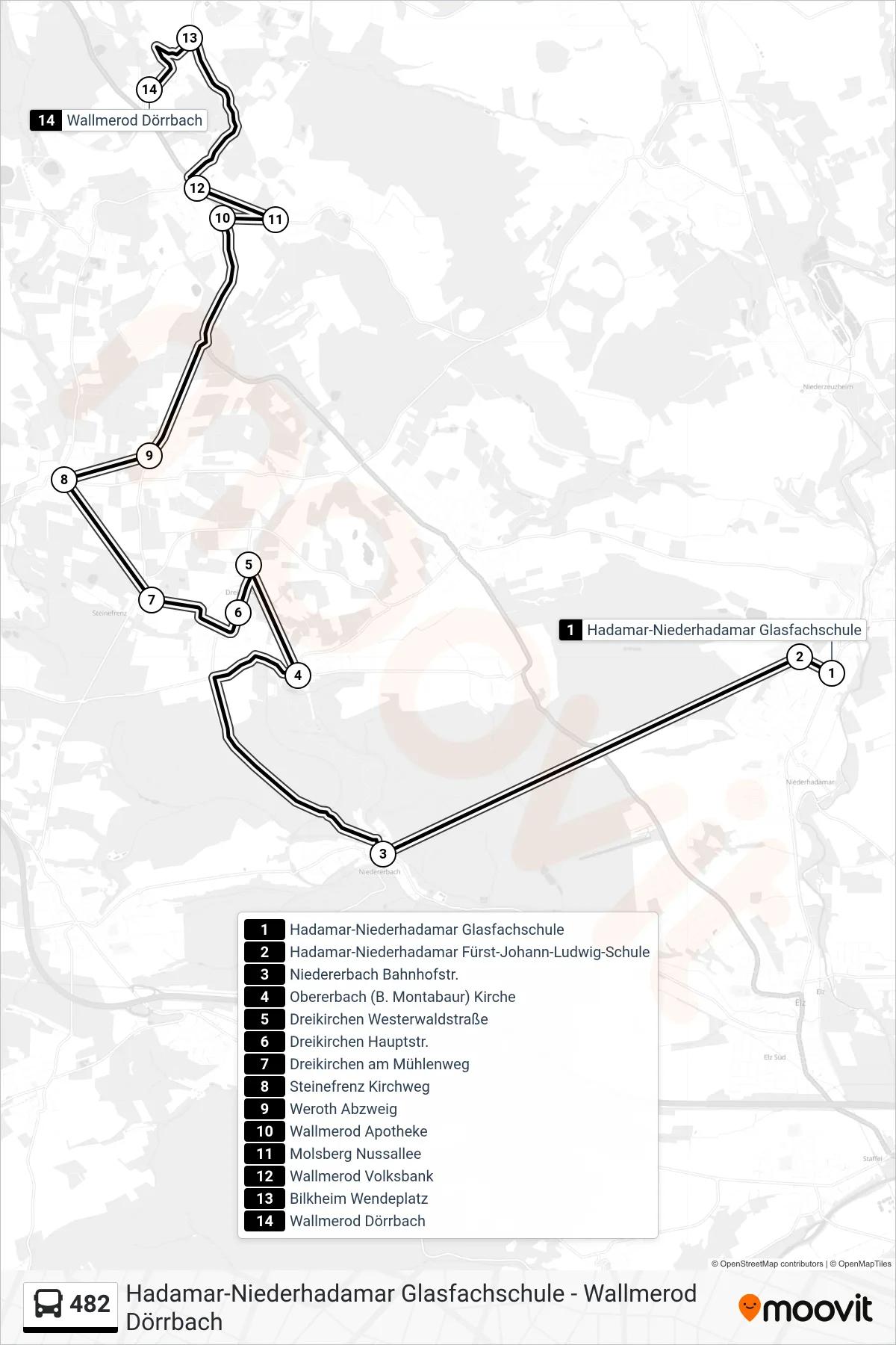
Stops list (482 - Wallmerod Dörrbach)
- Hadamar-Niederhadamar Glasfachschule
- Hadamar-Niederhadamar Fürst-Johann-Ludwig-Schule
- Niedererbach Bahnhofstr.
- Obererbach (B. Montabaur) Kirche
- Dreikirchen Westerwaldstraße
- Dreikirchen Hauptstr.
- Dreikirchen am Mühlenweg
- Steinefrenz Kirchweg
- Weroth Abzweig
- Wallmerod Apotheke
- Molsberg Nussallee
- Wallmerod Volksbank
- Bilkheim Wendeplatz
- Wallmerod Dörrbach
Change direction
- Route Map - 482 - Montabaur Schulzentrum
- Route Map - 482 - Obererbach (B. Montabaur) Florheckstr.
- Route Map - 482 - Hundsangen Kindergarten
- Route Map - 482 - Meudt Bahnhofstraße
- Route Map - 482 - Heiligenroth Dgh
- Route Map - 482 - Obererbach (B. Montabaur) Florheckstr.
- Route Map - 482 - Montabaur Konrad-Adenauer-Platz
- Route Map - 482 - Hadamar-Niederhadamar Fürst-Johann-Ludwig-Schule
- Route Map - 482 - Ruppach-Goldhausen Kindergarten
- Route Map - 482 - Heiligenroth Industriestraße Ost
- Route Map - 482 - Obererbach (B. Montabaur) Kirche
- Route Map - 482 - Weroth Mittelstraße
- Route Map - 482 - Weroth Grundschule
- Route Map - 482 - Hundsangen Bürgermeisteramt
- Route Map - 482 - Montabaur Bf
- Route Map - 482 - Dreikirchen am Mühlenweg