
48X Bus Route Map
View the 48X route map and see all 48X stops along the route. The map of 48X shows where the bus travels and the location of each stop, making it easy to understand the entire route at a glance.
Explore Sonoma County Transit routes on the map and see where Sonoma County Transit bus services operate. Use the 48X map to find bus stops and see how the 48X connects different areas along its trip.
All 48X stops on the map are displayed in route order, helping you follow the 48X bus from the first stop to the last.
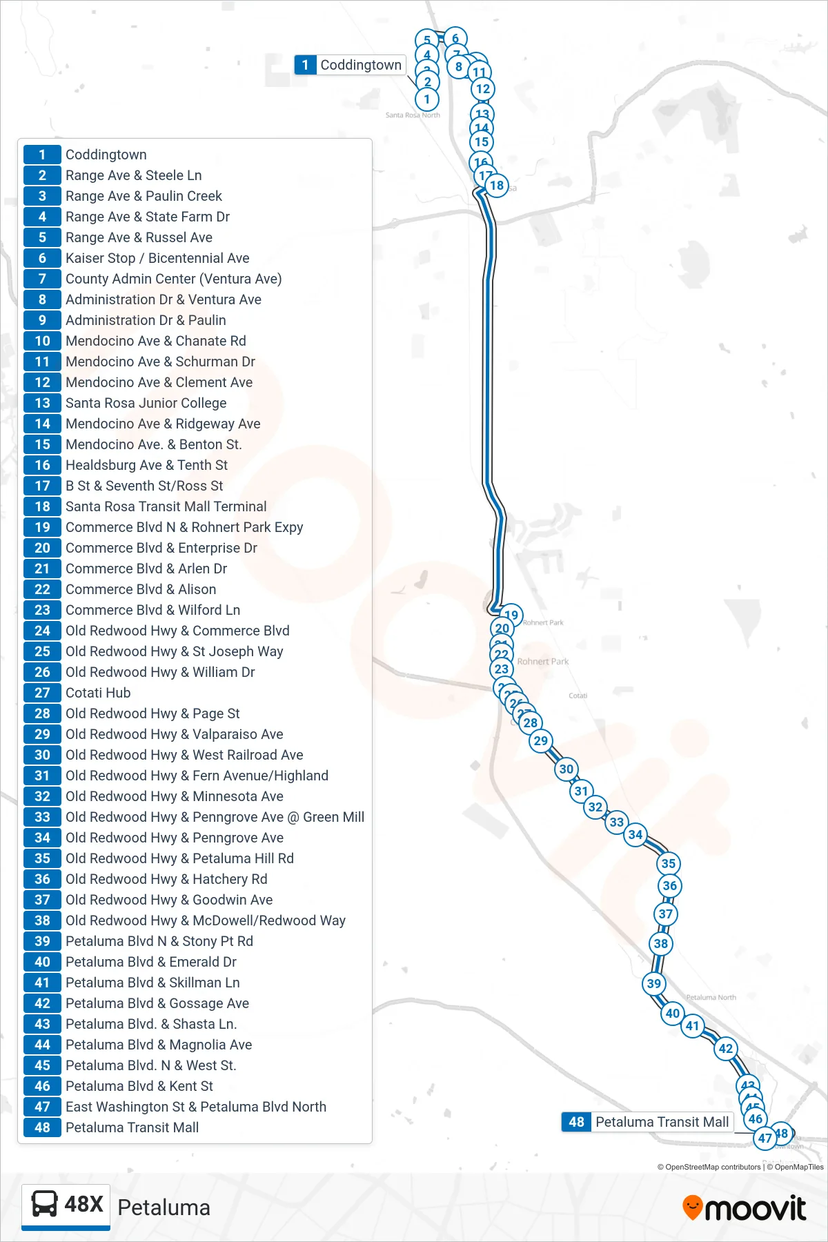
Stops list (48X - Petaluma)
- Coddingtown
- Range Ave & Steele Ln
- Range Ave & Paulin Creek
- Range Ave & State Farm Dr
- Range Ave & Russel Ave
- Kaiser Stop / Bicentennial Ave
- County Admin Center (Ventura Ave)
- Administration Dr & Ventura Ave
- Administration Dr & Paulin
- Mendocino Ave & Chanate Rd
- Mendocino Ave & Schurman Dr
- Mendocino Ave & Clement Ave
- Santa Rosa Junior College
- Mendocino Ave & Ridgeway Ave
- Mendocino Ave. & Benton St.
- Healdsburg Ave & Tenth St
- B St & Seventh St/Ross St
- Santa Rosa Transit Mall Terminal
- Commerce Blvd N & Rohnert Park Expy
- Commerce Blvd & Enterprise Dr
- Commerce Blvd & Arlen Dr
- Commerce Blvd & Alison
- Commerce Blvd & Wilford Ln
- Old Redwood Hwy & Commerce Blvd
- Old Redwood Hwy & St Joseph Way
- Old Redwood Hwy & William Dr
- Cotati Hub
- Old Redwood Hwy & Page St
- Old Redwood Hwy & Valparaiso Ave
- Old Redwood Hwy & West Railroad Ave
- Old Redwood Hwy & Fern Avenue/Highland
- Old Redwood Hwy & Minnesota Ave
- Old Redwood Hwy & Penngrove Ave @ Green Mill
- Old Redwood Hwy & Penngrove Ave
- Old Redwood Hwy & Petaluma Hill Rd
- Old Redwood Hwy & Hatchery Rd
- Old Redwood Hwy & Goodwin Ave
- Old Redwood Hwy & McDowell/Redwood Way
- Petaluma Blvd N & Stony Pt Rd
- Petaluma Blvd & Emerald Dr
- Petaluma Blvd & Skillman Ln
- Petaluma Blvd & Gossage Ave
- Petaluma Blvd. & Shasta Ln.
- Petaluma Blvd & Magnolia Ave
- Petaluma Blvd. N & West St.
- Petaluma Blvd & Kent St
- East Washington St & Petaluma Blvd North
- Petaluma Transit Mall