
490 Bus Route Map
View the 490 route map and see all 490 stops along the route. The map of 490 shows where the bus travels and the location of each stop, making it easy to understand the entire route at a glance.
Explore Nazareth Travel and Tourism routes on the map and see where Nazareth Travel and Tourism bus services operate. Use the 490 map to find bus stops and see how the 490 connects different areas along its trip.
All 490 stops on the map are displayed in route order, helping you follow the 490 bus from the first stop to the last.
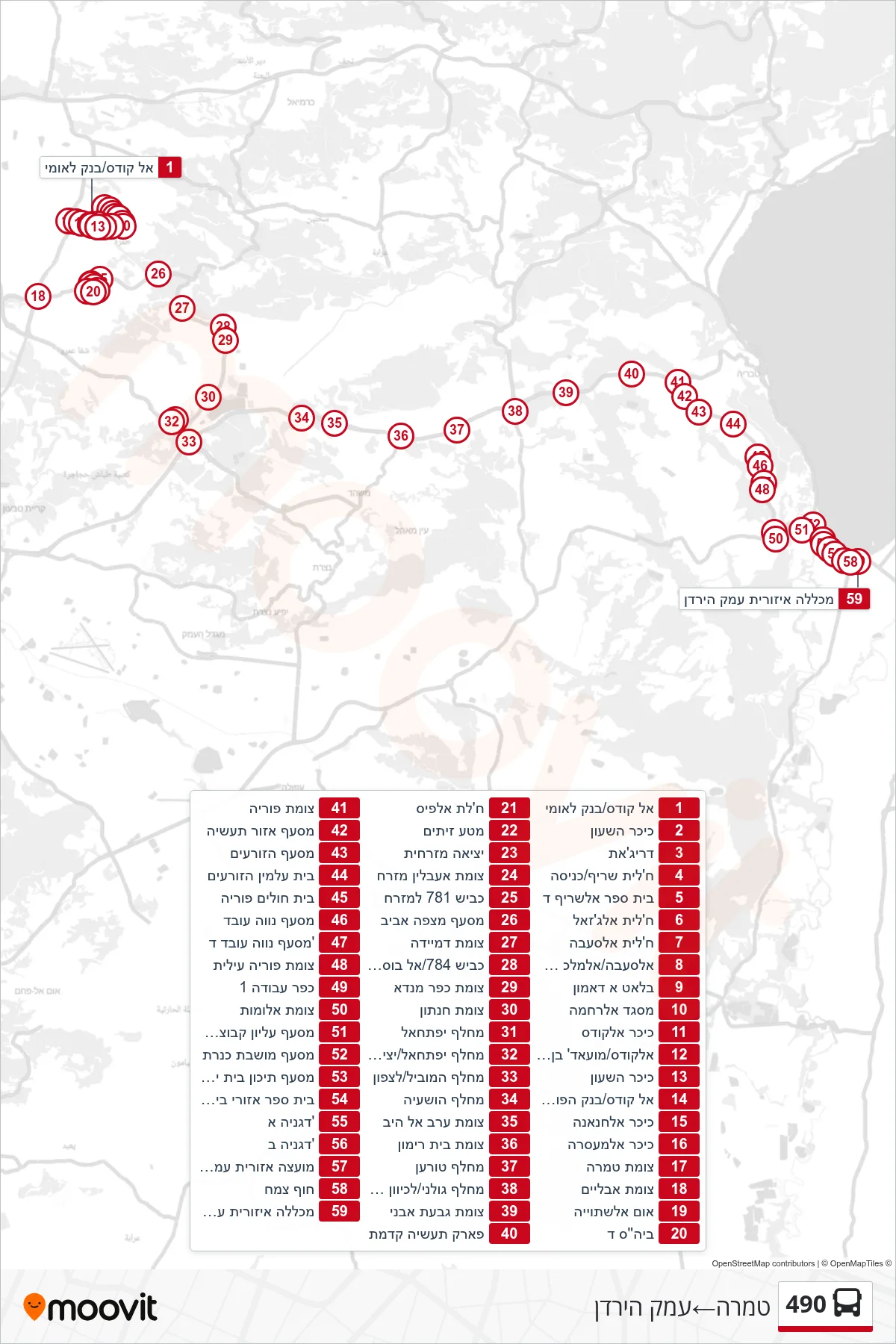
Stops list (490 - Tamra→Emek HaYarden)
- Al Quds/Bank Leumi
- Clock Tower
- Drijat
- Khalit Sharif/Entrance
- Al-Sharif School D
- Khalit al-Ghazal
- Khalit Al-Sa'aba
- Al-Saba/Al-Malik Suleiman
- Blat Al-Damon
- Al-Rahma Mosque
- Al-Quds Square
- Al-Quds/Muadh ibn Jabal
- Clock Tower
- Al Quds/Bank Hapoalim
- Al-Hananah Square
- Al-Masara Square
- Tamra Junction
- Avlayim Junction
- Um Al-Shtuyyeh
- School D
- Khalet al-Fis
- Olive Grove
- Eastern Exit
- Iblin East Junction
- Road 781 East
- Mitzpe Aviv Junction
- Dmeide Junction
- Road 784/Al Bustan
- Kfar Manda Junction
- Hanaton Junction
- Yiftachel Interchange
- Yiftachel Interchange/Exit to Road 79
- HaMovil Interchange/North
- Hoshaya Interchange
- Arab al-Heib Junction
- Beit Rimon Junction
- Toran Junction
- Golani Interchange/Eastbound
- Givat Avni Junction
- Kidmat Industrial Park
- Poriya Junction
- Industrial Zone Junction
- HaZorim Junction
- Hazorim Cemetery
- Poriya Hospital
- Neve Oved Junction
- Neve Oved D Junction
- Poriya Illit Junction
- Work Village 1
- Alumot Junction
- מסעף עליון קבוצת כנרת
- Kinneret Colony Junction
- מסעף תיכון בית ירח לדרום
- Beit Yerach Regional School
- Degania A
- Degania B
- Jordan Valley Regional Council
- Tzemach Beach
- Jordan Valley Regional College