
4B Bus Route Map
View the 4B route map and see all 4B stops along the route. The map of 4B shows where the bus travels and the location of each stop, making it easy to understand the entire route at a glance.
Explore GoDurham routes on the map and see where GoDurham bus services operate. Use the 4B map to find bus stops and see how the 4B connects different areas along its trip.
All 4B stops on the map are displayed in route order, helping you follow the 4B bus from the first stop to the last.
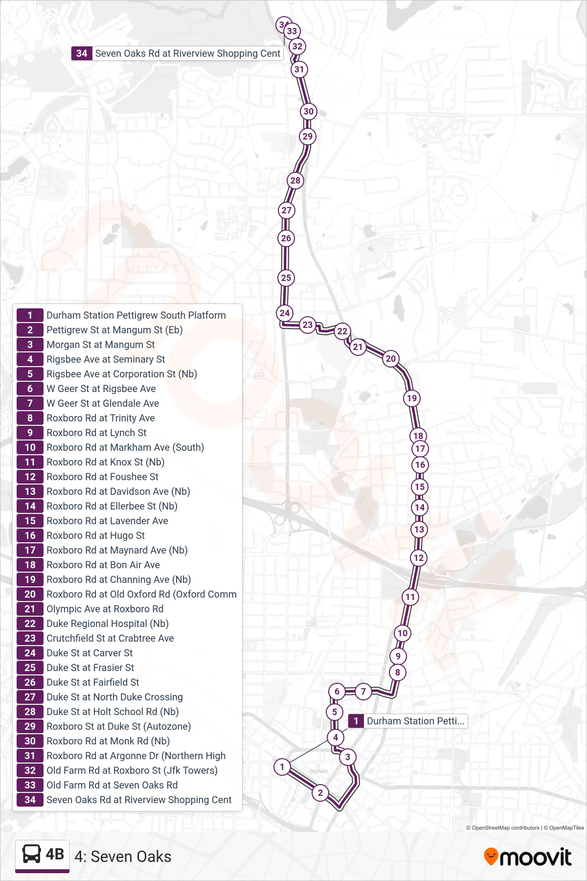
Stops list (4B - 4: Seven Oaks)
- Durham Station Pettigrew South Platform
- Pettigrew St at Mangum St (Eb)
- Morgan St at Mangum St
- Rigsbee Ave at Seminary St
- Rigsbee Ave at Corporation St (Nb)
- W Geer St at Rigsbee Ave
- W Geer St at Glendale Ave
- Roxboro Rd at Trinity Ave
- Roxboro Rd at Lynch St
- Roxboro Rd at Markham Ave (South)
- Roxboro Rd at Knox St (Nb)
- Roxboro Rd at Foushee St
- Roxboro Rd at Davidson Ave (Nb)
- Roxboro Rd at Ellerbee St (Nb)
- Roxboro Rd at Lavender Ave
- Roxboro Rd at Hugo St
- Roxboro Rd at Maynard Ave (Nb)
- Roxboro Rd at Bon Air Ave
- Roxboro Rd at Channing Ave (Nb)
- Roxboro Rd at Old Oxford Rd (Oxford Comm
- Olympic Ave at Roxboro Rd
- Duke Regional Hospital (Nb)
- Crutchfield St at Crabtree Ave
- Duke St at Carver St
- Duke St at Frasier St
- Duke St at Fairfield St
- Duke St at North Duke Crossing
- Duke St at Holt School Rd (Nb)
- Roxboro St at Duke St (Autozone)
- Roxboro Rd at Monk Rd (Nb)
- Roxboro Rd at Argonne Dr (Northern High
- Old Farm Rd at Roxboro St (Jfk Towers)
- Old Farm Rd at Seven Oaks Rd
- Seven Oaks Rd at Riverview Shopping Cent