
5 Bus Route Map
View the 5 route map and see all 5 stops along the route. The map of 5 shows where the bus travels and the location of each stop, making it easy to understand the entire route at a glance.
Explore ATAF routes on the map and see where ATAF bus services operate. Use the 5 map to find bus stops and see how the 5 connects different areas along its trip.
All 5 stops on the map are displayed in route order, helping you follow the 5 bus from the first stop to the last.
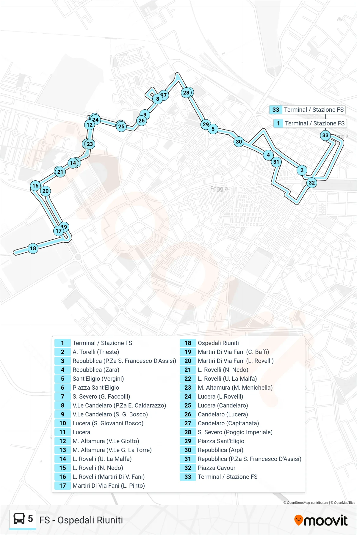
Stops list (5 - Terminal / Railway Station→Terminal / Railway Station)
- Terminal / Railway Station
- A. Torelli (Trieste)
- Republic (St. Francis of Assisi Square)
- Repubblica (Zara)
- Sant'Eligio (Vergini)
- Sant'Eligio Square
- S. Severo (G. Faccolli)
- V.Le Candelaro (P.Za E. Caldarazzo)
- Viale Candelaro (San Giovanni Bosco)
- Lucera (St. Giovanni Bosco)
- Lucera
- M. Altamura (Viale Giotto)
- M. Altamura (G. La Torre Avenue)
- L. Rovelli (U. La Malfa)
- L. Rovelli (N. Nedo)
- L. Rovelli (Martyrs of V. Fani)
- Martyrs of Fani Street (L. Pinto)
- United Hospitals
- Martyrs of Via Fani (C. Baffi)
- Martyrs of Via Fani (L. Rovelli)
- L. Rovelli (N. Nedo)
- L. Rovelli (U. La Malfa)
- M. Altamura (M. Menichella)
- Lucera (L.Rovelli)
- Lucera (Candelaro)
- Candelaro (Lucera)
- Candelaro (Capitanata)
- San Severo (Poggio Imperiale)
- Sant'Eligio Square
- Repubblica (Arpi)
- Republic (St. Francis of Assisi Square)
- Cavour Square
- Terminal / Railway Station