
5 Bus Route Map
View the 5 route map and see all 5 stops along the route. The map of 5 shows where the bus travels and the location of each stop, making it easy to understand the entire route at a glance.
Explore Sydtrafik routes on the map and see where Sydtrafik bus services operate. Use the 5 map to find bus stops and see how the 5 connects different areas along its trip.
All 5 stops on the map are displayed in route order, helping you follow the 5 bus from the first stop to the last.
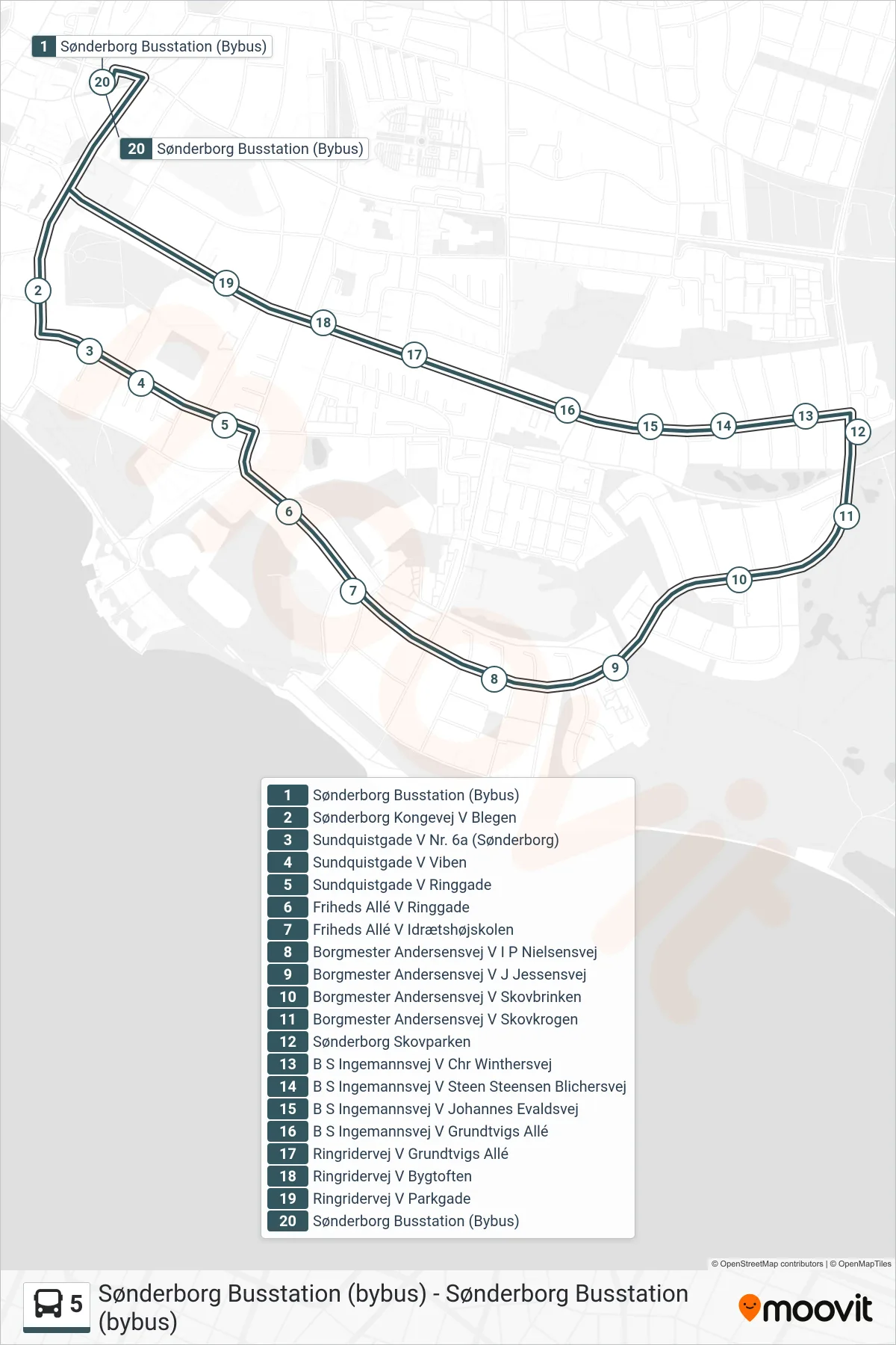
Stops list (5 - Sønderborg Busstation (Bybus))
- Sønderborg Busstation (Bybus)
- Sønderborg Kongevej V Blegen
- Sundquistgade V Nr. 6a (Sønderborg)
- Sundquistgade V Viben
- Sundquistgade V Ringgade
- Friheds Allé V Ringgade
- Friheds Allé V Idrætshøjskolen
- Borgmester Andersensvej V I P Nielsensvej
- Borgmester Andersensvej V J Jessensvej
- Borgmester Andersensvej V Skovbrinken
- Borgmester Andersensvej V Skovkrogen
- Sønderborg Skovparken
- B S Ingemannsvej V Chr Winthersvej
- B S Ingemannsvej V Steen Steensen Blichersvej
- B S Ingemannsvej V Johannes Evaldsvej
- B S Ingemannsvej V Grundtvigs Allé
- Ringridervej V Grundtvigs Allé
- Ringridervej V Bygtoften
- Ringridervej V Parkgade
- Sønderborg Busstation (Bybus)