
5 Bus Route Map
View the 5 route map and see all 5 stops along the route. The map of 5 shows where the bus travels and the location of each stop, making it easy to understand the entire route at a glance.
Explore Cities Area Transit routes on the map and see where Cities Area Transit bus services operate. Use the 5 map to find bus stops and see how the 5 connects different areas along its trip.
All 5 stops on the map are displayed in route order, helping you follow the 5 bus from the first stop to the last.
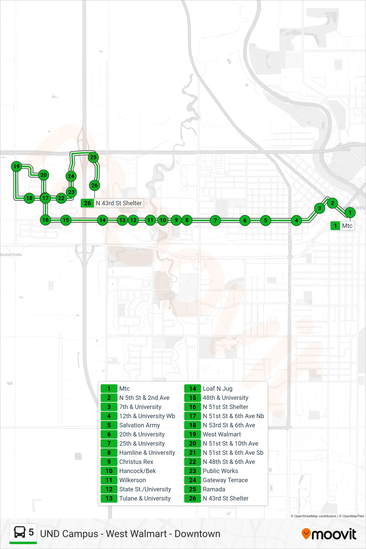
Stops list (5 - Mtc→N 43rd St Shelter)
- Mtc
- N 5th St & 2nd Ave
- 7th & University
- 12th & University Wb
- Salvation Army
- 20th & University
- 25th & University
- Hamline & University
- Christus Rex
- Hancock/Bek
- Wilkerson
- State St./University
- Tulane & University
- Loaf N Jug
- 48th & University
- N 51st St Shelter
- N 51st St & 6th Ave Nb
- N 53rd St & 6th Ave
- West Walmart
- N 51st St & 10th Ave
- N 51st St & 6th Ave Sb
- N 48th St & 6th Ave
- Public Works
- Gateway Terrace
- Ramada
- N 43rd St Shelter