
5 Bus Route Map
View the 5 route map and see all 5 stops along the route. The map of 5 shows where the bus travels and the location of each stop, making it easy to understand the entire route at a glance.
Explore Huntsville Transit routes on the map and see where Huntsville Transit bus services operate. Use the 5 map to find bus stops and see how the 5 connects different areas along its trip.
All 5 stops on the map are displayed in route order, helping you follow the 5 bus from the first stop to the last.
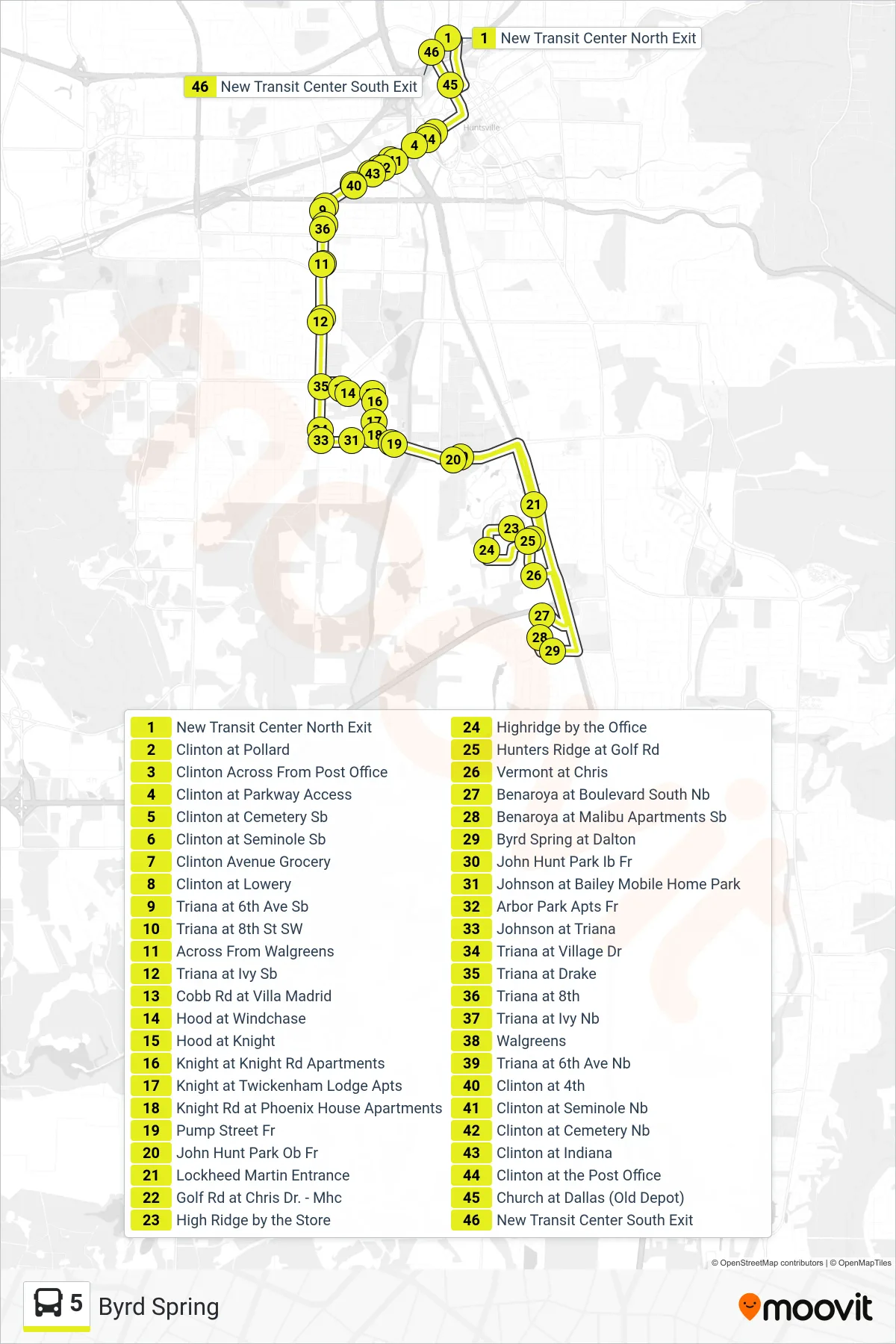
Stops list (5 - New Transit Center North Exit→New Transit Center South Exit)
- New Transit Center North Exit
- Clinton at Pollard
- Clinton Across From Post Office
- Clinton at Parkway Access
- Clinton at Cemetery Sb
- Clinton at Seminole Sb
- Clinton Avenue Grocery
- Clinton at Lowery
- Triana at 6th Ave Sb
- Triana at 8th St SW
- Across From Walgreens
- Triana at Ivy Sb
- Cobb Rd at Villa Madrid
- Hood at Windchase
- Hood at Knight
- Knight at Knight Rd Apartments
- Knight at Twickenham Lodge Apts
- Knight Rd at Phoenix House Apartments
- Pump Street Fr
- John Hunt Park Ob Fr
- Lockheed Martin Entrance
- Golf Rd at Chris Dr. - Mhc
- High Ridge by the Store
- Highridge by the Office
- Hunters Ridge at Golf Rd
- Vermont at Chris
- Benaroya at Boulevard South Nb
- Benaroya at Malibu Apartments Sb
- Byrd Spring at Dalton
- John Hunt Park Ib Fr
- Johnson at Bailey Mobile Home Park
- Arbor Park Apts Fr
- Johnson at Triana
- Triana at Village Dr
- Triana at Drake
- Triana at 8th
- Triana at Ivy Nb
- Walgreens
- Triana at 6th Ave Nb
- Clinton at 4th
- Clinton at Seminole Nb
- Clinton at Cemetery Nb
- Clinton at Indiana
- Clinton at the Post Office
- Church at Dallas (Old Depot)
- New Transit Center South Exit