
5 Bus Route Map
View the 5 route map and see all 5 stops along the route. The map of 5 shows where the bus travels and the location of each stop, making it easy to understand the entire route at a glance.
Explore Frölich Linie routes on the map and see where Frölich Linie bus services operate. Use the 5 map to find bus stops and see how the 5 connects different areas along its trip.
All 5 stops on the map are displayed in route order, helping you follow the 5 bus from the first stop to the last.
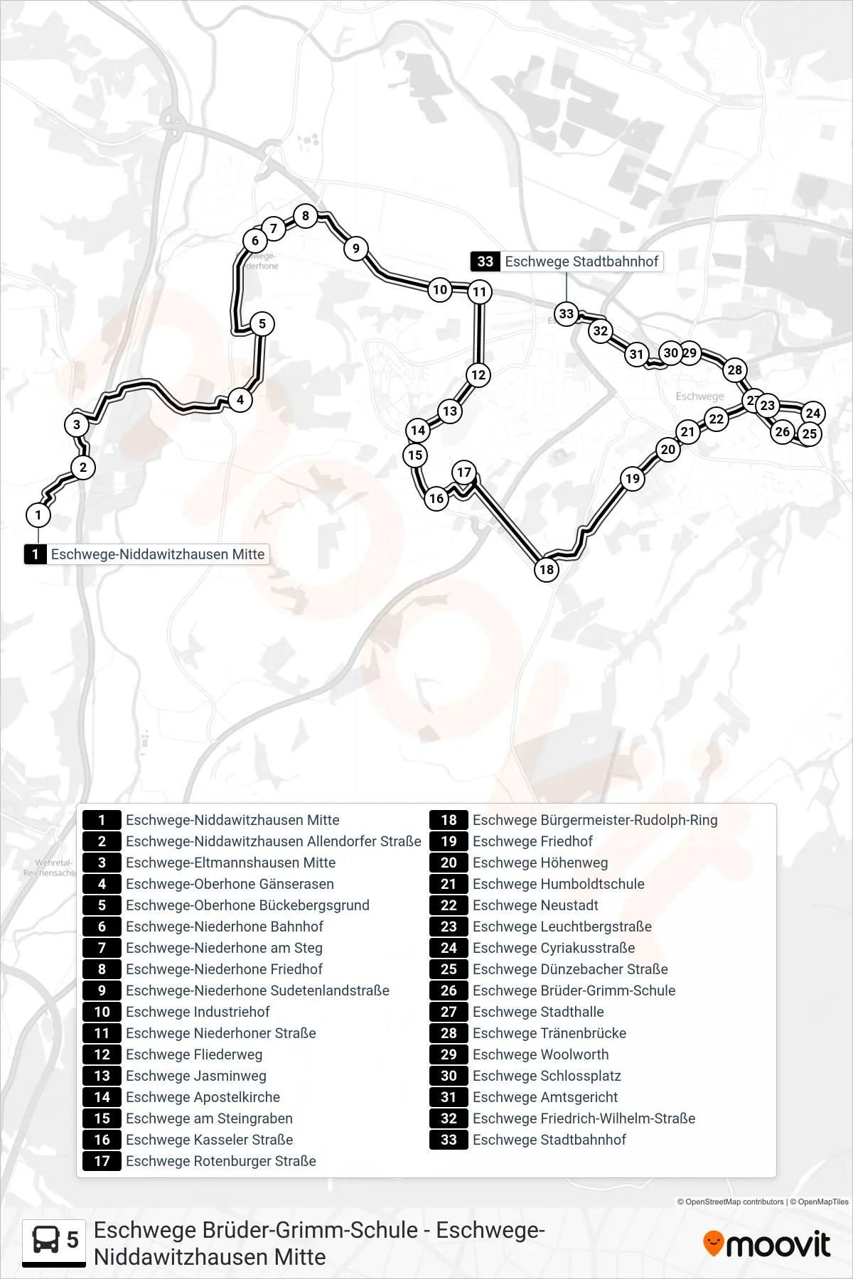
Stops list (5 - Stadtbahnhof)
- Eschwege-Niddawitzhausen Mitte
- Eschwege-Niddawitzhausen Allendorfer Straße
- Eschwege-Eltmannshausen Mitte
- Eschwege-Oberhone Gänserasen
- Eschwege-Oberhone Bückebergsgrund
- Eschwege-Niederhone Bahnhof
- Eschwege-Niederhone am Steg
- Eschwege-Niederhone Friedhof
- Eschwege-Niederhone Sudetenlandstraße
- Eschwege Industriehof
- Eschwege Niederhoner Straße
- Eschwege Fliederweg
- Eschwege Jasminweg
- Eschwege Apostelkirche
- Eschwege am Steingraben
- Eschwege Kasseler Straße
- Eschwege Rotenburger Straße
- Eschwege Bürgermeister-Rudolph-Ring
- Eschwege Friedhof
- Eschwege Höhenweg
- Eschwege Humboldtschule
- Eschwege Neustadt
- Eschwege Leuchtbergstraße
- Eschwege Cyriakusstraße
- Eschwege Dünzebacher Straße
- Eschwege Brüder-Grimm-Schule
- Eschwege Stadthalle
- Eschwege Tränenbrücke
- Eschwege Woolworth
- Eschwege Schlossplatz
- Eschwege Amtsgericht
- Eschwege Friedrich-Wilhelm-Straße
- Eschwege Stadtbahnhof