
5 Tram Route Map
View the 5 route map and see all 5 stops along the route. The map of 5 shows where the tram travels and the location of each stop, making it easy to understand the entire route at a glance.
Explore GVB routes on the map and see where GVB tram services operate. Use the 5 map to find tram stations and see how the 5 connects different areas along its trip.
All 5 stops on the map are displayed in route order, helping you follow the 5 tram from the first station to the last.
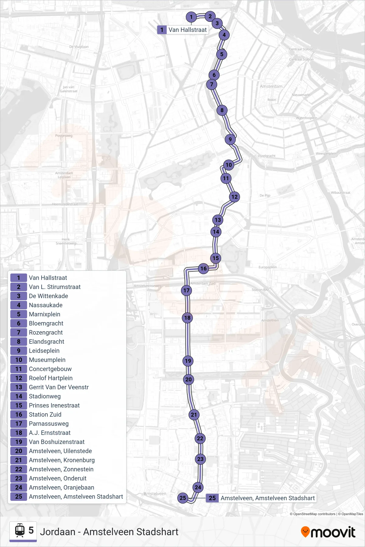
Stops list (5 - Amstelveen Stadshart)
- Van Hallstraat
- Van L. Stirumstraat
- De Wittenkade
- Nassaukade
- Marnixplein
- Bloemgracht
- Rozengracht
- Elandsgracht
- Leidseplein
- Museumplein
- Concertgebouw
- Frederiksplein
- Albert Cuypstraat
- Roelof Hartplein
- Ceintuurbaan
- 2e Van Der Helststraat
- De Pijp
- Roelof Hartplein
- Gerrit Van Der Veenstr
- Stadionweg
- Prinses Irenestraat
- Station Zuid Wtc-Zijde
- Station Zuid
- Station Zuid
- Parnassusweg
- A.J. Ernststraat
- Van Boshuizenstraat
- Amstelveen, Uilenstede
- Amstelveen, Kronenburg
- Amstelveen, Zonnestein
- Amstelveen, Onderuit
- Amstelveen, Oranjebaan
- Amstelveen, Amstelveen Stadshart