
5 Bus Route Map
View the 5 route map and see all 5 stops along the route. The map of 5 shows where the bus travels and the location of each stop, making it easy to understand the entire route at a glance.
Explore Breng routes on the map and see where Breng bus services operate. Use the 5 map to find bus stops and see how the 5 connects different areas along its trip.
All 5 stops on the map are displayed in route order, helping you follow the 5 bus from the first stop to the last.
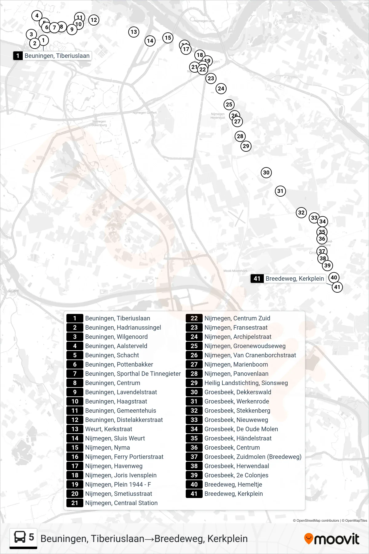
Stops list (5 - Groesbeek Breedeweg)
- Beuningen, Tiberiuslaan
- Beuningen, Hadrianussingel
- Beuningen, Wilgenoord
- Beuningen, Aalsterveld
- Beuningen, Schacht
- Beuningen, Pottenbakker
- Beuningen, Sporthal De Tinnegieter
- Beuningen, Centrum
- Beuningen, Lavendelstraat
- Beuningen, Haagstraat
- Beuningen, Gemeentehuis
- Beuningen, Distelakkerstraat
- Weurt, Kerkstraat
- Nijmegen, Sluis Weurt
- Nijmegen, Nyma
- Nijmegen, Ferry Portierstraat
- Nijmegen, Havenweg
- Nijmegen, Joris Ivensplein
- Nijmegen, Plein 1944 - F
- Nijmegen, Smetiusstraat
- Nijmegen, Centraal Station
- Nijmegen, Centrum Zuid
- Nijmegen, Fransestraat
- Nijmegen, Archipelstraat
- Nijmegen, Groenewoudseweg
- Nijmegen, Van Cranenborchstraat
- Nijmegen, Marienboom
- Nijmegen, Panovenlaan
- Heilig Landstichting, Sionsweg
- Groesbeek, Dekkerswald
- Groesbeek, Werkenrode
- Groesbeek, Stekkenberg
- Groesbeek, Nieuweweg
- Groesbeek, De Oude Molen
- Groesbeek, Händelstraat
- Groesbeek, Centrum
- Groesbeek, Zuidmolen (Breedeweg)
- Groesbeek, Herwendaal
- Groesbeek, 2e Colonjes
- Breedeweg, Hemeltje
- Breedeweg, Kerkplein