
5 Tram Route Map
View the 5 route map and see all 5 stops along the route. The map of 5 shows where the tram travels and the location of each stop, making it easy to understand the entire route at a glance.
Explore routes on the map and see where tram services operate. Use the 5 map to find tram stations and see how the 5 connects different areas along its trip.
All 5 stops on the map are displayed in route order, helping you follow the 5 tram from the first station to the last.
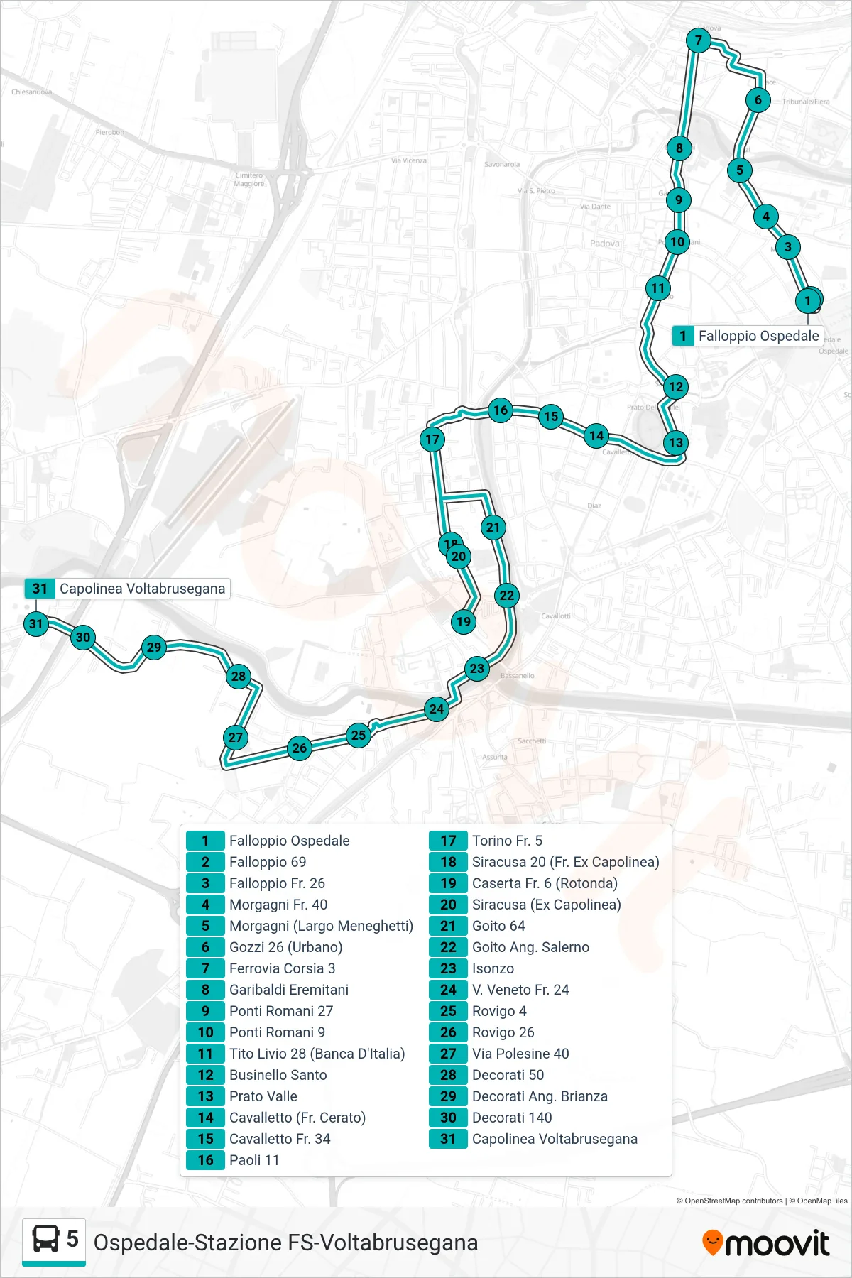
Stops list (5 - Hospital > Railway > Voltabrusegana Terminal)
- Falloppio Hospital
- Falloppio 69
- Falloppio No. 26
- Morgagni No. 40
- Morgagni (Largo Meneghetti)
- Gozzi 26 (Urban)
- Railway Track 3
- Garibaldi Eremitani
- Roman Bridges 27
- Roman Bridges 9
- Tito Livio 28 (Bank of Italy)
- Santo Businello
- Prato Valle
- Cavalletto (Near Cerato)
- Cavalletto St. 34
- Paoli 11
- Turin Fr. 5
- Siracusa 20 (Former Terminal)
- Caserta Junction 6 (Roundabout)
- Siracusa (Former Terminal)
- Goito 64
- Goito Corner Salerno
- Isonzo
- V. Veneto Fr. 24
- Rovigo 4
- Rovigo 26
- Polesine Street 40
- Decorati 50
- Decorati Corner Brianza
- Decorati 140
- Voltabrusegana Terminal