
5 Bus Route Map
View the 5 route map and see all 5 stops along the route. The map of 5 shows where the bus travels and the location of each stop, making it easy to understand the entire route at a glance.
Explore GoRaleigh routes on the map and see where GoRaleigh bus services operate. Use the 5 map to find bus stops and see how the 5 connects different areas along its trip.
All 5 stops on the map are displayed in route order, helping you follow the 5 bus from the first stop to the last.
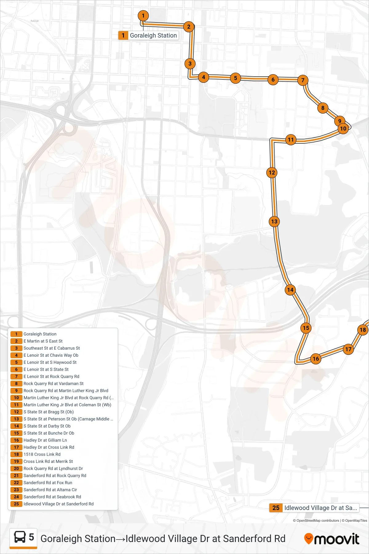
Stops list (5 - Goraleigh Station→Idlewood Village Dr at Sanderford Rd)
- Goraleigh Station
- E Martin at S East St
- Southeast St at E Cabarrus St
- E Lenoir St at Chavis Way Ob
- E Lenoir St at S Haywood St
- E Lenoir St at S State St
- E Lenoir St at Rock Quarry Rd
- Rock Quarry Rd at Vardaman St
- Rock Quarry Rd at Martin Luther King Jr Blvd
- Martin Luther King Jr Blvd at Rock Quarry Rd (Wb)
- Martin Luther King Jr Blvd at Coleman St (Wb)
- S State St at Bragg St (Ob)
- S State St at Peterson St Ob (Carnage Middle Schoo
- S State St at Darby St Ob
- S State St at Bunche Dr Ob
- Hadley Dr at Gilliam Ln
- Hadley Dr at Cross Link Rd
- 1518 Cross Link Rd
- Cross Link Rd at Merrik St
- Rock Quarry Rd at Lyndhurst Dr
- Sanderford Rd at Rock Quarry Rd
- Sanderford Rd at Fox Run
- Sanderford Rd at Altama Cir
- Sanderford Rd at Seabrook Rd
- Idlewood Village Dr at Sanderford Rd