
5 Bus Route Map
View the 5 route map and see all 5 stops along the route. The map of 5 shows where the bus travels and the location of each stop, making it easy to understand the entire route at a glance.
Explore Aachener Straßenbahn- und Energieversorgungs-AG routes on the map and see where Aachener Straßenbahn- und Energieversorgungs-AG bus services operate. Use the 5 map to find bus stops and see how the 5 connects different areas along its trip.
All 5 stops on the map are displayed in route order, helping you follow the 5 bus from the first stop to the last.
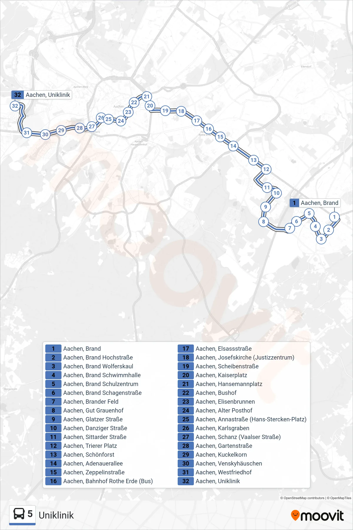
Stops list (5 - Uniklinik)
- Aachen, Brand
- Aachen, Brand Hochstraße
- Aachen, Brand Wolferskaul
- Aachen, Brand Schwimmhalle
- Aachen, Brand Schulzentrum
- Aachen, Brand Schagenstraße
- Aachen, Brander Feld
- Aachen, Gut Grauenhof
- Aachen, Glatzer Straße
- Aachen, Danziger Straße
- Aachen, Sittarder Straße
- Aachen, Trierer Platz
- Aachen, Schönforst
- Aachen, Adenauerallee
- Aachen, Zeppelinstraße
- Aachen, Bahnhof Rothe Erde (Bus)
- Aachen, Elsassstraße
- Aachen, Josefskirche (Justizzentrum)
- Aachen, Scheibenstraße
- Aachen, Kaiserplatz
- Aachen, Hansemannplatz
- Aachen, Bushof
- Aachen, Elisenbrunnen
- Aachen, Alter Posthof
- Aachen, Annastraße (Hans-Stercken-Platz)
- Aachen, Karlsgraben
- Aachen, Schanz (Vaalser Straße)
- Aachen, Gartenstraße
- Aachen, Kuckelkorn
- Aachen, Venskyhäuschen
- Aachen, Westfriedhof
- Aachen, Uniklinik