
5 Bus Route Map
View the 5 route map and see all 5 stops along the route. The map of 5 shows where the bus travels and the location of each stop, making it easy to understand the entire route at a glance.
Explore Stadtwerke Hamm GmbH - Verkehrsbetrieb routes on the map and see where Stadtwerke Hamm GmbH - Verkehrsbetrieb bus services operate. Use the 5 map to find bus stops and see how the 5 connects different areas along its trip.
All 5 stops on the map are displayed in route order, helping you follow the 5 bus from the first stop to the last.
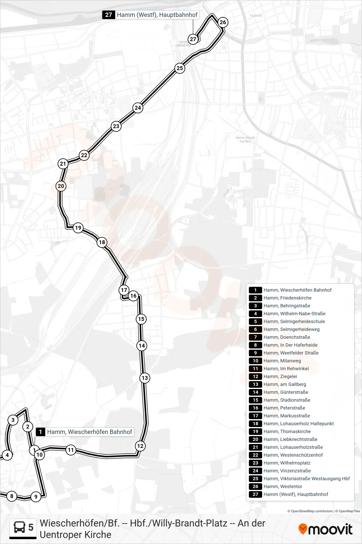
Stops list (5 - Hamm (Westf), Hauptbahnhof Bstg 3)
- Hamm, Wiescherhöfen Bahnhof
- Hamm, Friedenskirche
- Hamm, Behringstraße
- Hamm, Wilhelm-Nabe-Straße
- Hamm, Selmigerheideschule
- Hamm, Selmigerheideweg
- Hamm, Doenchstraße
- Hamm, In Der Haferheide
- Hamm, Weetfelder Straße
- Hamm, Milanweg
- Hamm, Im Rehwinkel
- Hamm, Ziegelei
- Hamm, am Gallberg
- Hamm, Günterstraße
- Hamm, Stadionstraße
- Hamm, Peterstraße
- Hamm, Markusstraße
- Hamm, Lohauserholz Haltepunkt
- Hamm, Thomaskirche
- Hamm, Liebknechtstraße
- Hamm, Lohauserholzstraße
- Hamm, Westenschützenhof
- Hamm, Wilhelmsplatz
- Hamm, Vinzenzstraße
- Hamm, Viktoriastraße Westausgang Hbf
- Hamm, Westentor
- Hamm (Westf), Hauptbahnhof