
5 Bus Route Map
View the 5 route map and see all 5 stops along the route. The map of 5 shows where the bus travels and the location of each stop, making it easy to understand the entire route at a glance.
Explore SWU routes on the map and see where SWU bus services operate. Use the 5 map to find bus stops and see how the 5 connects different areas along its trip.
All 5 stops on the map are displayed in route order, helping you follow the 5 bus from the first stop to the last.
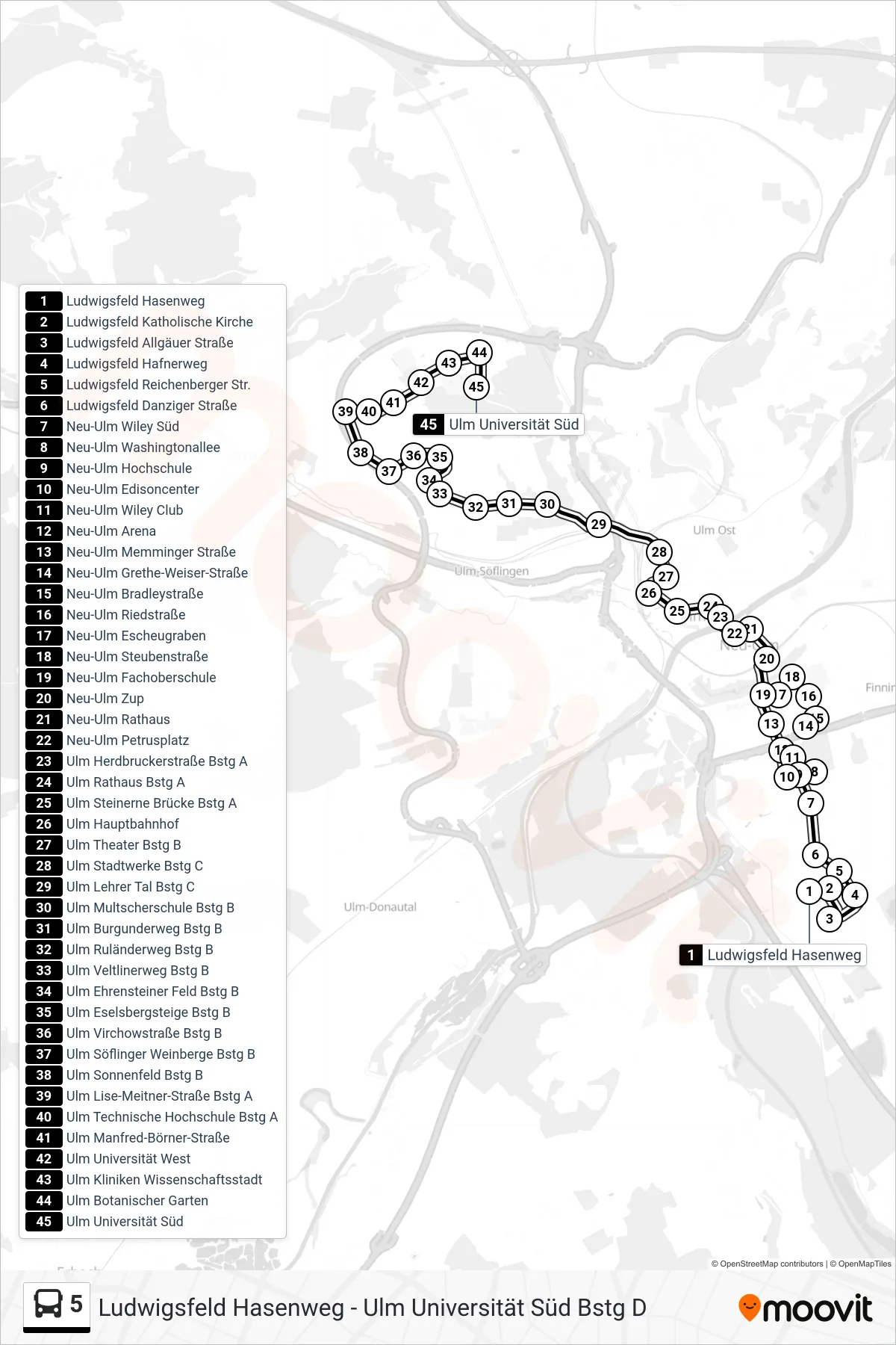
Stops list (5 - Ulm Universität Süd)
- Ludwigsfeld Hasenweg
- Ludwigsfeld Katholische Kirche
- Ludwigsfeld Allgäuer Straße
- Ludwigsfeld Hafnerweg
- Ludwigsfeld Reichenberger Str.
- Ludwigsfeld Danziger Straße
- Neu-Ulm Wiley Süd
- Neu-Ulm Washingtonallee
- Neu-Ulm Hochschule
- Neu-Ulm Edisoncenter
- Neu-Ulm Wiley Club
- Neu-Ulm Arena
- Neu-Ulm Memminger Straße
- Neu-Ulm Grethe-Weiser-Straße
- Neu-Ulm Bradleystraße
- Neu-Ulm Riedstraße
- Neu-Ulm Escheugraben
- Neu-Ulm Steubenstraße
- Neu-Ulm Fachoberschule
- Neu-Ulm Zup
- Neu-Ulm Rathaus
- Neu-Ulm Petrusplatz
- Ulm Herdbruckerstraße Bstg A
- Ulm Rathaus Bstg A
- Ulm Steinerne Brücke Bstg A
- Ulm Hauptbahnhof
- Ulm Theater Bstg B
- Ulm Stadtwerke Bstg C
- Ulm Lehrer Tal Bstg C
- Ulm Multscherschule Bstg B
- Ulm Burgunderweg Bstg B
- Ulm Ruländerweg Bstg B
- Ulm Veltlinerweg Bstg B
- Ulm Ehrensteiner Feld Bstg B
- Ulm Eselsbergsteige Bstg B
- Ulm Virchowstraße Bstg B
- Ulm Söflinger Weinberge Bstg B
- Ulm Sonnenfeld Bstg B
- Ulm Lise-Meitner-Straße Bstg A
- Ulm Technische Hochschule Bstg A
- Ulm Manfred-Börner-Straße
- Ulm Universität West
- Ulm Kliniken Wissenschaftsstadt
- Ulm Botanischer Garten
- Ulm Universität Süd