
50 Cable Car Route Map
View the 50 route map and see all 50 stops along the route. The map of 50 shows where the cable car travels and the location of each stop, making it easy to understand the entire route at a glance.
Explore KP Kyivpastrans routes on the map and see where KP Kyivpastrans cable car services operate. Use the 50 map to find cable car stations and see how the 50 connects different areas along its trip.
All 50 stops on the map are displayed in route order, helping you follow the 50 cable car from the first station to the last.
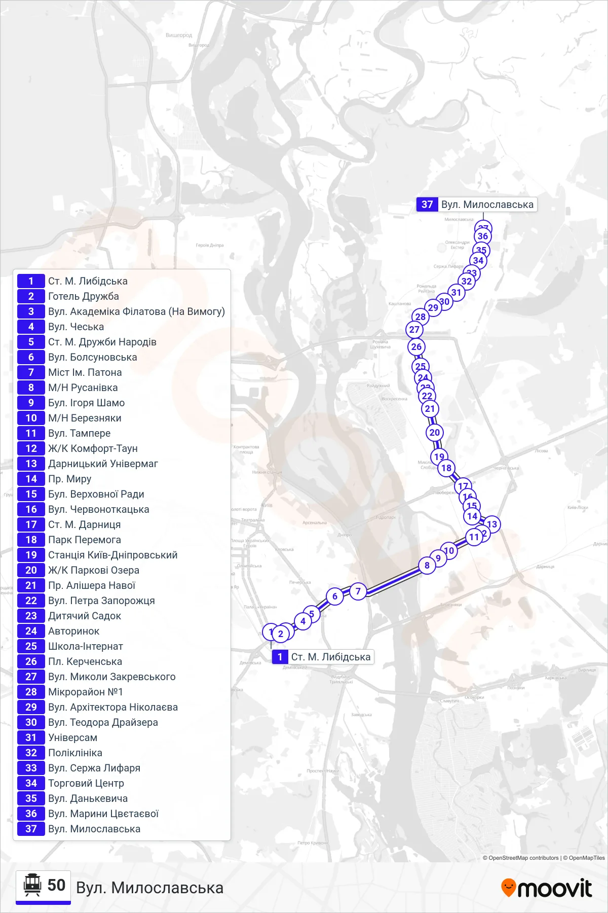
Stops list (50 - Myloslavska St.)
- Lybidska Metro Station
- Druzhba Hotel
- Akademika Filatova Street (On Demand)
- Czech Street
- Druzhby Narodiv Metro Station
- Bolsunovska Street
- Paton Bridge
- Rusanivka District
- Igor Shamo Boulevard
- Berezniaky District
- Tampere Street
- Comfort Town Complex
- Darnytskyi Department Store
- Peace Avenue
- Verkhovnoi Rady Blvd
- Chervonotkatska Street
- Darnitsa Metro Station
- Peremoha Park
- Kyiv-Dniprovsky Station
- Park Lakes Residential Complex
- Alisher Navoi Avenue
- Petra Zaporozhtsia St
- Kindergarten
- Car Market
- Boarding School
- Kerchenska Square
- Mykoly Zakrevskoho Street
- Microdistrict 1
- Architect Nikolaev Street
- Theodore Dreiser Street
- Universam
- Polyclinic
- Serzha Lyfaria Street
- Shopping Center
- Dankevycha St
- Maryna Tsvetaeva Street
- Myloslavska St.