
50 Bus Route Map
View the 50 route map and see all 50 stops along the route. The map of 50 shows where the bus travels and the location of each stop, making it easy to understand the entire route at a glance.
Explore KP Kyivpastrans routes on the map and see where KP Kyivpastrans bus services operate. Use the 50 map to find bus stops and see how the 50 connects different areas along its trip.
All 50 stops on the map are displayed in route order, helping you follow the 50 bus from the first stop to the last.
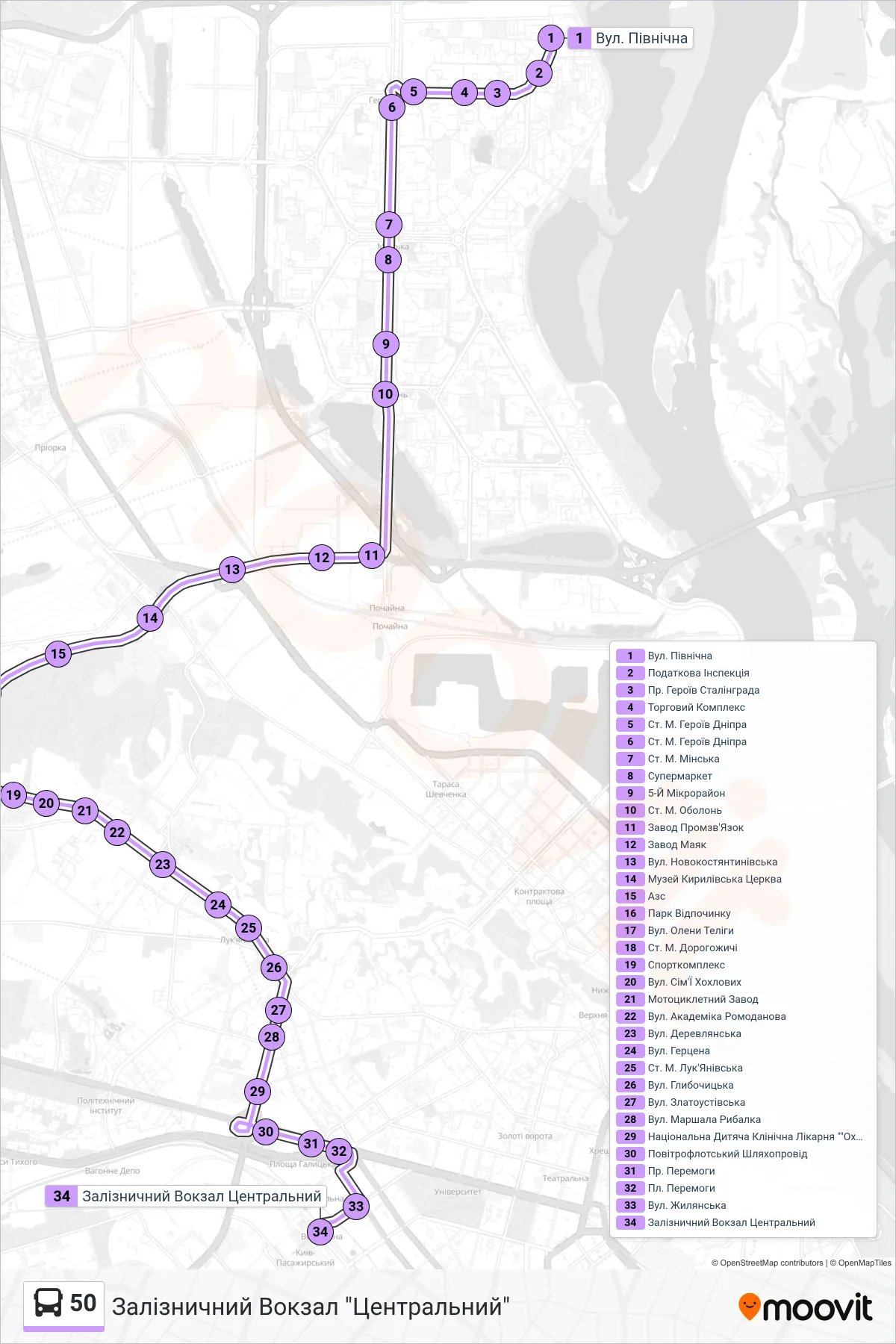
Stops list (50 - Central Railway Station)
- North Street
- Tax Inspection
- Heroiv Stalinhrada Avenue
- Shopping Complex
- Heroes of Dnieper Metro Station
- Heroes of Dnieper Metro Station
- Minska Metro Station
- Supermarket
- 5th Microdistrict
- Obolon Metro Station
- Promzvyazok Factory
- Mayak Factory
- Novokostiantynivska St.
- Kyrylivska Church Museum
- Gas Station
- Rest Park
- Oleny Telihy Street
- Dorohozhychi Metro Station
- Sports Complex
- Sim'i Khokhlovykh Street
- Motorcycle Factory
- Akademika Romodanova St.
- Derevlianska St.
- Herzen Street
- Lukianivska Metro Station
- Hlybochytska Street
- Zlatoustivska Street
- Marshal Rybalka Street
- National Children's Clinical Hospital "Okhmatdyt"
- Povitroflotskyi Overpass
- Victory Avenue
- Victory Square
- Zhylianska St
- Central Railway Station