
50 Bus Route Map
View the 50 route map and see all 50 stops along the route. The map of 50 shows where the bus travels and the location of each stop, making it easy to understand the entire route at a glance.
Explore Autobuses routes on the map and see where Autobuses bus services operate. Use the 50 map to find bus stops and see how the 50 connects different areas along its trip.
All 50 stops on the map are displayed in route order, helping you follow the 50 bus from the first stop to the last.
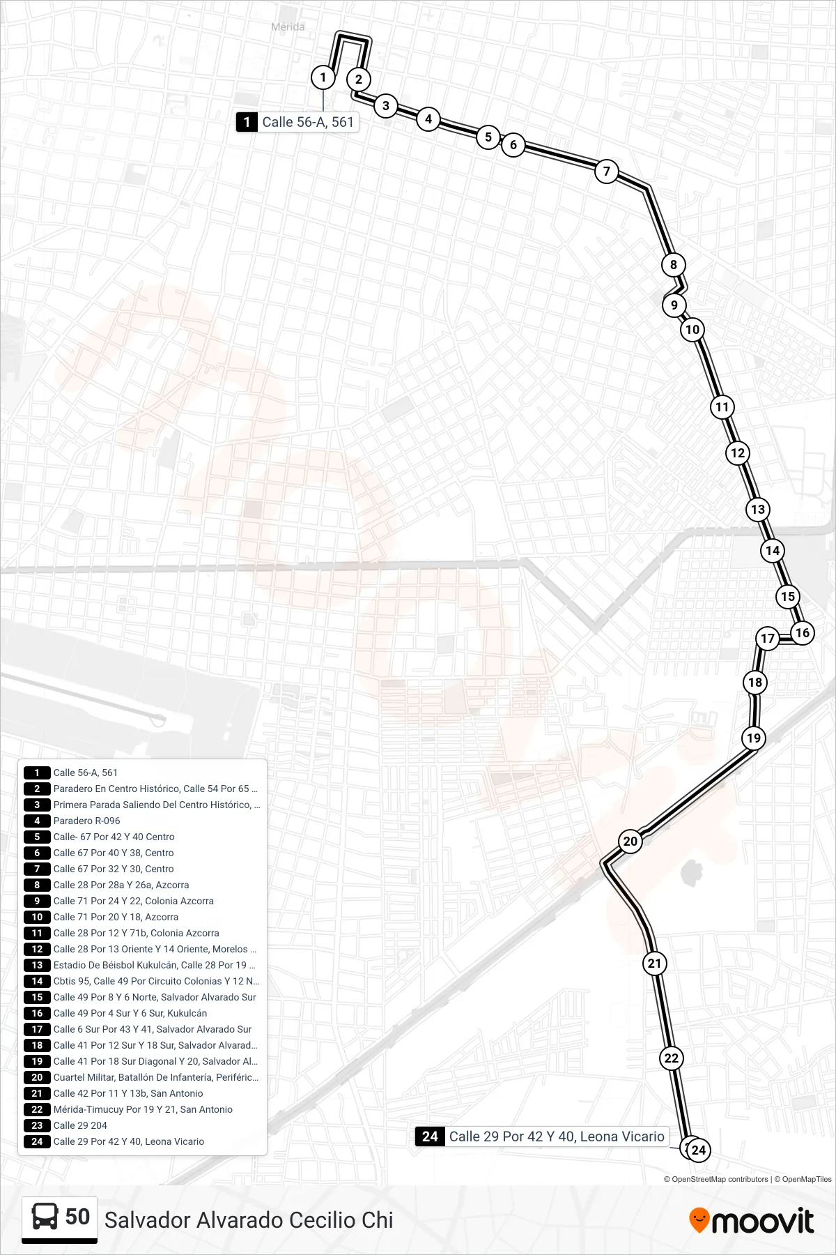
Stops list (50 - Salvador Alvarado Cecilio Chi)
- Calle 56-A, 561
- Paradero En Centro Histórico, Calle 54 Por 65 Y 67, Centro
- Primera Parada Saliendo Del Centro Histórico, Calle 67 Por 52 Y 50, Centro
- Paradero R-096
- Calle- 67 Por 42 Y 40 Centro
- Calle 67 Por 40 Y 38, Centro
- Calle 67 Por 32 Y 30, Centro
- Calle 28 Por 28a Y 26a, Azcorra
- Calle 71 Por 24 Y 22, Colonia Azcorra
- Calle 71 Por 20 Y 18, Azcorra
- Calle 28 Por 12 Y 71b, Colonia Azcorra
- Calle 28 Por 13 Oriente Y 14 Oriente, Morelos Oriente
- Estadio De Béisbol Kukulcán, Calle 28 Por 19 Pte Y 81pte, Fraccionamiento Unidad Morelos
- Cbtis 95, Calle 49 Por Circuito Colonias Y 12 Nte, Colonia Salvador Alvarado Sur
- Calle 49 Por 8 Y 6 Norte, Salvador Alvarado Sur
- Calle 49 Por 4 Sur Y 6 Sur, Kukulcán
- Calle 6 Sur Por 43 Y 41, Salvador Alvarado Sur
- Calle 41 Por 12 Sur Y 18 Sur, Salvador Alvarado Sur
- Calle 41 Por 18 Sur Diagonal Y 20, Salvador Alvarado Sur II
- Cuartel Militar, Batallón De Infantería, Periférico Mérida-Campeche
- Calle 42 Por 11 Y 13b, San Antonio
- Mérida-Timucuy Por 19 Y 21, San Antonio
- Calle 29 204
- Calle 29 Por 42 Y 40, Leona Vicario