
50 Bus Route Map
View the 50 route map and see all 50 stops along the route. The map of 50 shows where the bus travels and the location of each stop, making it easy to understand the entire route at a glance.
Explore Rīgas satiksme routes on the map and see where Rīgas satiksme bus services operate. Use the 50 map to find bus stops and see how the 50 connects different areas along its trip.
All 50 stops on the map are displayed in route order, helping you follow the 50 bus from the first stop to the last.
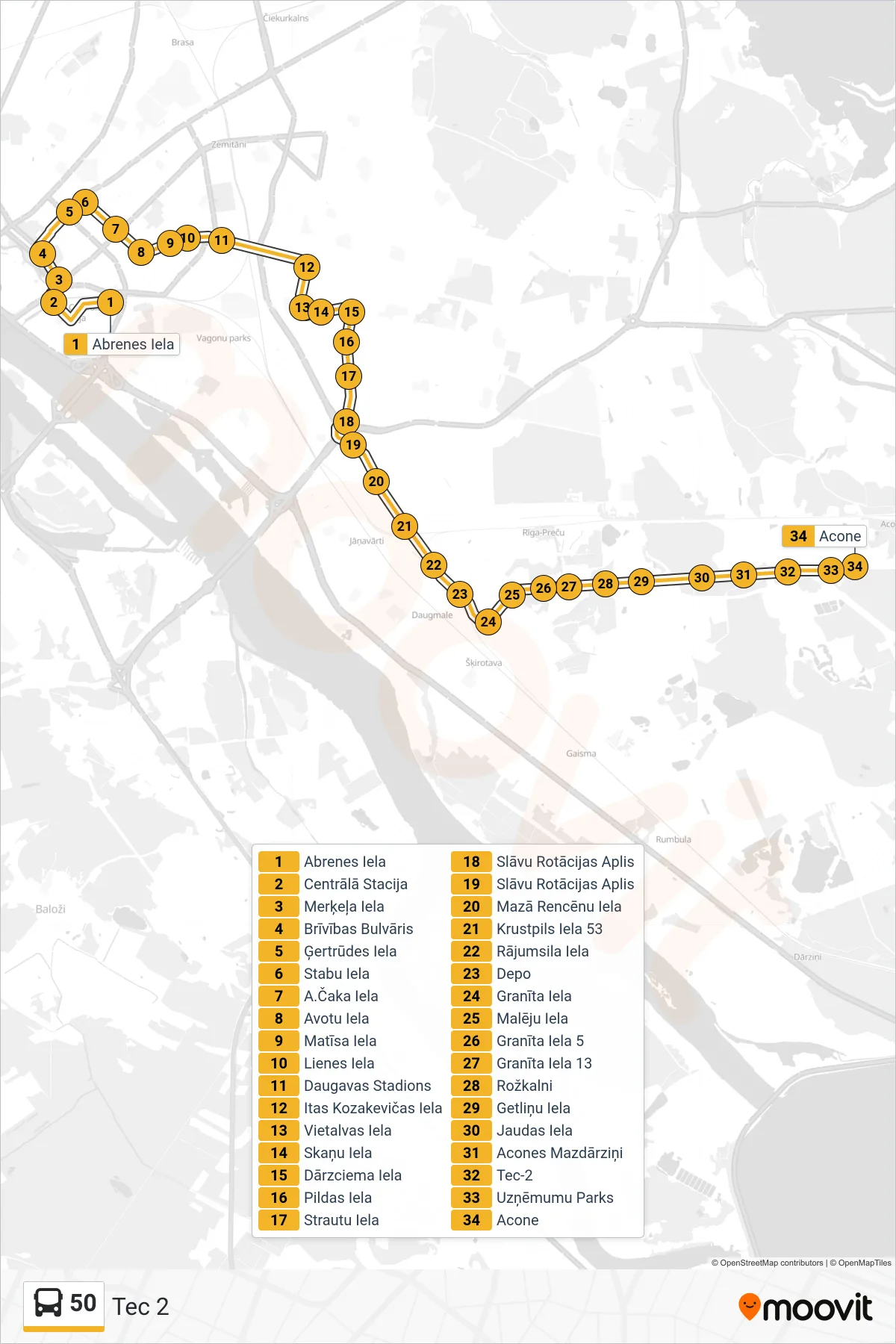
Stops list (50 - Tec 2)
- Abrenes Iela
- Centrālā Stacija
- Merķeļa Iela
- Brīvības Bulvāris
- Ģertrūdes Iela
- Stabu Iela
- A.Čaka Iela
- Avotu Iela
- Matīsa Iela
- Lienes Iela
- Daugavas Stadions
- Itas Kozakevičas Iela
- Vietalvas Iela
- Skaņu Iela
- Dārzciema Iela
- Pildas Iela
- Strautu Iela
- Slāvu Rotācijas Aplis
- Slāvu Rotācijas Aplis
- Mazā Rencēnu Iela
- Krustpils Iela 53
- Rājumsila Iela
- Depo
- Granīta Iela
- Malēju Iela
- Granīta Iela 5
- Granīta Iela 13
- Rožkalni
- Getliņu Iela
- Jaudas Iela
- Acones Mazdārziņi
- Tec-2
- Uzņēmumu Parks
- Acone