
50 Bus Route Map
View the 50 route map and see all 50 stops along the route. The map of 50 shows where the bus travels and the location of each stop, making it easy to understand the entire route at a glance.
Explore Transit Services of Frederick County routes on the map and see where Transit Services of Frederick County bus services operate. Use the 50 map to find bus stops and see how the 50 connects different areas along its trip.
All 50 stops on the map are displayed in route order, helping you follow the 50 bus from the first stop to the last.
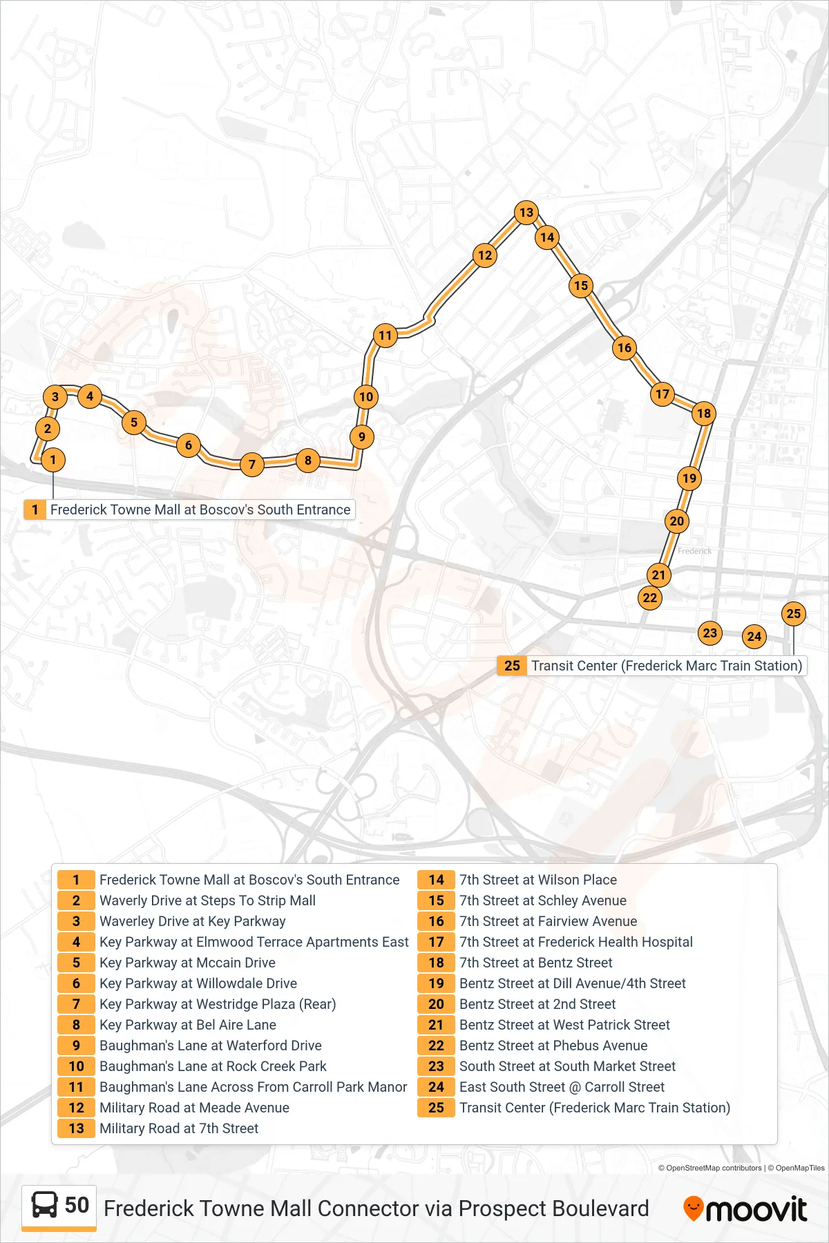
Stops list (50 - Transit Center)
- Frederick Towne Mall at Boscov's South Entrance
- Waverly Drive at Steps To Strip Mall
- Waverley Drive at Key Parkway
- Key Parkway at Elmwood Terrace Apartments East
- Key Parkway at Mccain Drive
- Key Parkway at Willowdale Drive
- Key Parkway at Westridge Plaza (Rear)
- Key Parkway at Bel Aire Lane
- Baughman's Lane at Waterford Drive
- Baughman's Lane at Rock Creek Park
- Baughman's Lane Across From Carroll Park Manor
- Military Road at Meade Avenue
- Military Road at 7th Street
- 7th Street at Wilson Place
- 7th Street at Schley Avenue
- 7th Street at Fairview Avenue
- 7th Street at Frederick Health Hospital
- 7th Street at Bentz Street
- Bentz Street at Dill Avenue/4th Street
- Bentz Street at 2nd Street
- Bentz Street at West Patrick Street
- Bentz Street at Phebus Avenue
- South Street at South Market Street
- East South Street @ Carroll Street
- Transit Center (Frederick Marc Train Station)