
500 Bus Route Map
View the 500 route map and see all 500 stops along the route. The map of 500 shows where the bus travels and the location of each stop, making it easy to understand the entire route at a glance.
Explore Kavim routes on the map and see where Kavim bus services operate. Use the 500 map to find bus stops and see how the 500 connects different areas along its trip.
All 500 stops on the map are displayed in route order, helping you follow the 500 bus from the first stop to the last.
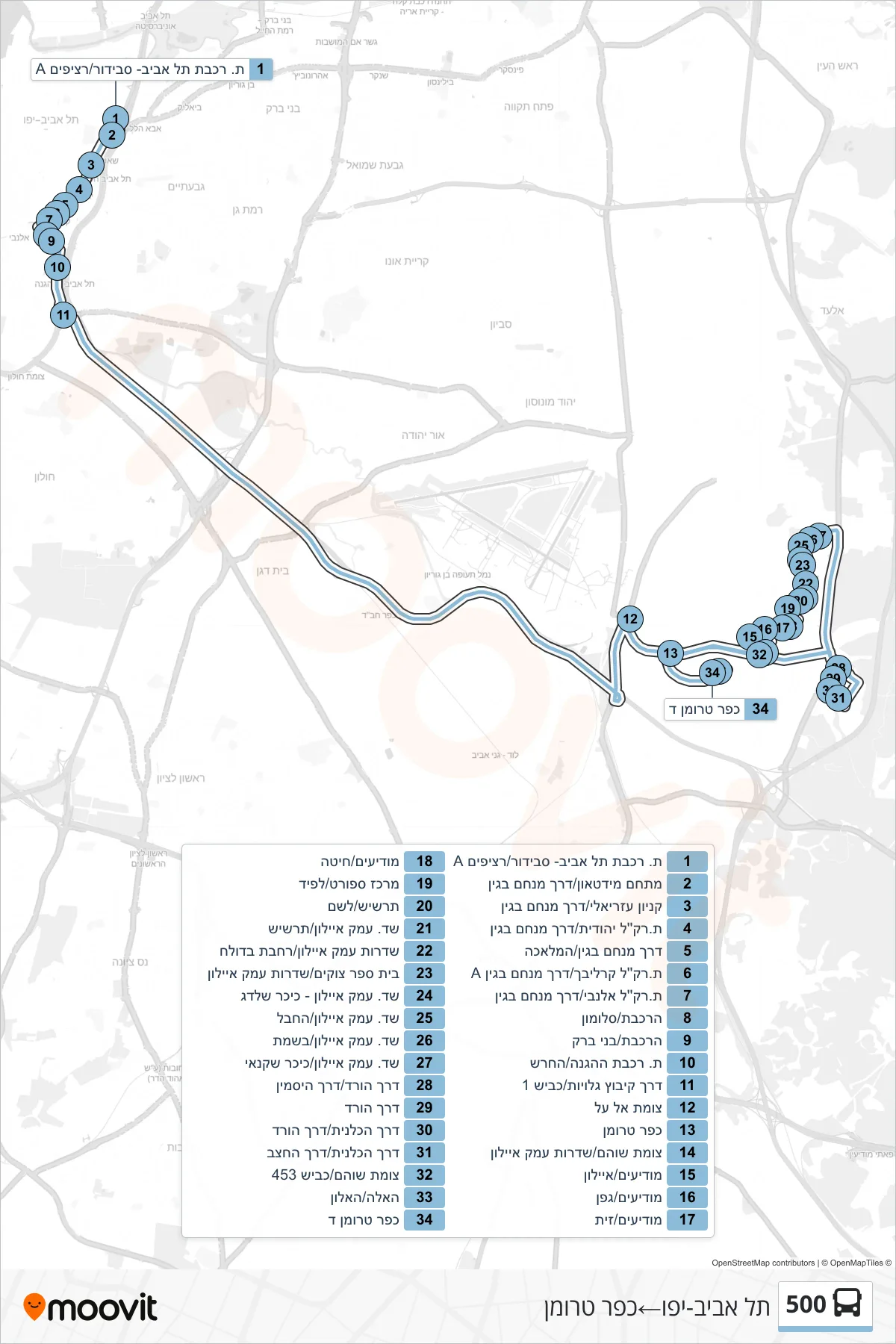
Stops list (500 - Tel Aviv-Yafo→Kfar Truman)
- Tel Aviv Savidor Station/Platform A
- Midtown Complex/Menachem Begin Road
- Azrieli Mall/Menachem Begin Road
- Yehudit Light Rail Station/Menachem Begin Road
- Menachem Begin Road/HaMelacha
- Karalibakh Light Rail Station/Menachem Begin Road A
- Allenby Light Rail Station/Menachem Begin Road
- HaRakevet/Solomon
- HaRakevet/Bnei Brak
- HaHagana/HaHaresh Railway Station
- Kibbutz Galuyot Road/Road 1
- Al Al Junction
- Kfar Truman
- Shoham Junction/Ayalon Valley Boulevard
- Modi'im/Ayalon
- Modiim/Gefen
- Modi'im/Zayit
- Modi'im/Hita
- Sports Center/Lapid
- Tarshish/Leshem
- Ayalon Valley Blvd/Tarshish
- Ayalon Valley Boulevard/Bdolach Square
- Tzukim School/Emek Ayalon Boulevard
- Emek Ayalon Blvd - Shaldag Square
- Ayalon Valley Blvd/HaChevel
- Emek Ayalon Blvd/Bosmat
- Ayalon Valley Blvd/Shachnai Square
- Rose Way/Jasmine Way
- HaVered Road
- HaKalanit Road/HaVered Road
- HaKalanit Road/HaHatzav Road
- Shoham Junction/Road 453
- HaEla/HaAlon
- Kfar Truman D