
500 Bus Route Map
View the 500 route map and see all 500 stops along the route. The map of 500 shows where the bus travels and the location of each stop, making it easy to understand the entire route at a glance.
Explore BKW Bad Wildungen routes on the map and see where BKW Bad Wildungen bus services operate. Use the 500 map to find bus stops and see how the 500 connects different areas along its trip.
All 500 stops on the map are displayed in route order, helping you follow the 500 bus from the first stop to the last.
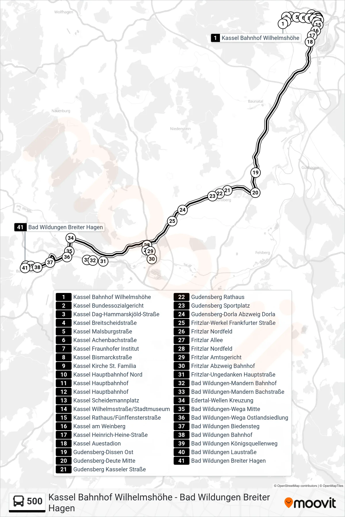
Stops list (500 - Bad Wildungen)
- Kassel Bahnhof Wilhelmshöhe
- Kassel Bundessozialgericht
- Kassel Dag-Hammarskjöld-Straße
- Kassel Breitscheidstraße
- Kassel Malsburgstraße
- Kassel Achenbachstraße
- Kassel Fraunhofer Institut
- Kassel Bismarckstraße
- Kassel Kirche St. Familia
- Kassel Hauptbahnhof Nord
- Kassel Hauptbahnhof
- Kassel Hauptbahnhof
- Kassel Scheidemannplatz
- Kassel Wilhelmsstraße/Stadtmuseum
- Kassel Rathaus/Fünffensterstraße
- Kassel am Weinberg
- Kassel Heinrich-Heine-Straße
- Kassel Auestadion
- Gudensberg-Dissen Ost
- Gudensberg-Deute Mitte
- Gudensberg Kasseler Straße
- Gudensberg Rathaus
- Gudensberg Sportplatz
- Gudensberg-Dorla Abzweig Dorla
- Fritzlar-Werkel Frankfurter Straße
- Fritzlar Nordfeld
- Fritzlar Allee
- Fritzlar Nordfeld
- Fritzlar Amtsgericht
- Fritzlar Abzweig Bahnhof
- Fritzlar-Ungedanken Hauptstraße
- Bad Wildungen-Mandern Bahnhof
- Bad Wildungen-Mandern Bachstraße
- Edertal-Wellen Kreuzung
- Bad Wildungen-Wega Mitte
- Bad Wildungen-Wega Ostlandsiedlung
- Bad Wildungen Biedensteg
- Bad Wildungen Bahnhof
- Bad Wildungen Königsquellenweg
- Bad Wildungen Laustraße
- Bad Wildungen Breiter Hagen