
500S Bus Route Map
View the 500S route map and see all 500S stops along the route. The map of 500S shows where the bus travels and the location of each stop, making it easy to understand the entire route at a glance.
Explore Movia routes on the map and see where Movia bus services operate. Use the 500S map to find bus stops and see how the 500S connects different areas along its trip.
All 500S stops on the map are displayed in route order, helping you follow the 500S bus from the first stop to the last.
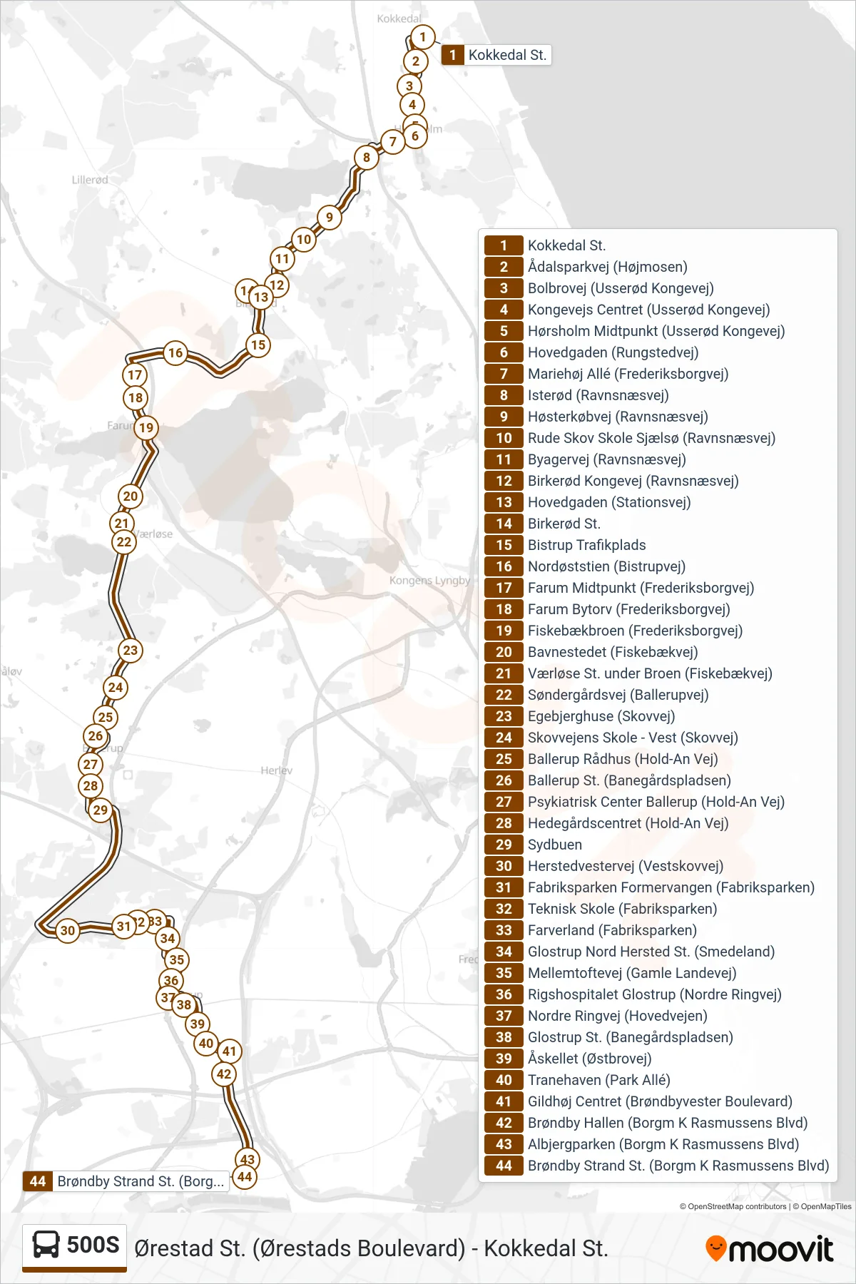
Stops list (500S - Brøndby Strand St.)
- Kokkedal St.
- Ådalsparkvej (Højmosen)
- Bolbrovej (Usserød Kongevej)
- Kongevejs Centret (Usserød Kongevej)
- Hørsholm Midtpunkt (Usserød Kongevej)
- Hovedgaden (Rungstedvej)
- Mariehøj Allé (Frederiksborgvej)
- Isterød (Ravnsnæsvej)
- Høsterkøbvej (Ravnsnæsvej)
- Rude Skov Skole Sjælsø (Ravnsnæsvej)
- Byagervej (Ravnsnæsvej)
- Birkerød Kongevej (Ravnsnæsvej)
- Hovedgaden (Stationsvej)
- Birkerød St.
- Bistrup Trafikplads
- Nordøststien (Bistrupvej)
- Farum Midtpunkt (Frederiksborgvej)
- Farum Bytorv (Frederiksborgvej)
- Fiskebækbroen (Frederiksborgvej)
- Bavnestedet (Fiskebækvej)
- Værløse St. under Broen (Fiskebækvej)
- Søndergårdsvej (Ballerupvej)
- Egebjerghuse (Skovvej)
- Skovvejens Skole - Vest (Skovvej)
- Ballerup Rådhus (Hold-An Vej)
- Ballerup St. (Banegårdspladsen)
- Psykiatrisk Center Ballerup (Hold-An Vej)
- Hedegårdscentret (Hold-An Vej)
- Sydbuen
- Herstedvestervej (Vestskovvej)
- Fabriksparken Formervangen (Fabriksparken)
- Teknisk Skole (Fabriksparken)
- Farverland (Fabriksparken)
- Glostrup Nord Hersted St. (Smedeland)
- Mellemtoftevej (Gamle Landevej)
- Rigshospitalet Glostrup (Nordre Ringvej)
- Nordre Ringvej (Hovedvejen)
- Glostrup St. (Banegårdspladsen)
- Åskellet (Østbrovej)
- Tranehaven (Park Allé)
- Gildhøj Centret (Brøndbyvester Boulevard)
- Brøndby Hallen (Borgm K Rasmussens Blvd)
- Albjergparken (Borgm K Rasmussens Blvd)
- Brøndby Strand St. (Borgm K Rasmussens Blvd)