
504 Bus Route Map
View the 504 route map and see all 504 stops along the route. The map of 504 shows where the bus travels and the location of each stop, making it easy to understand the entire route at a glance.
Explore PACE routes on the map and see where PACE bus services operate. Use the 504 map to find bus stops and see how the 504 connects different areas along its trip.
All 504 stops on the map are displayed in route order, helping you follow the 504 bus from the first stop to the last.
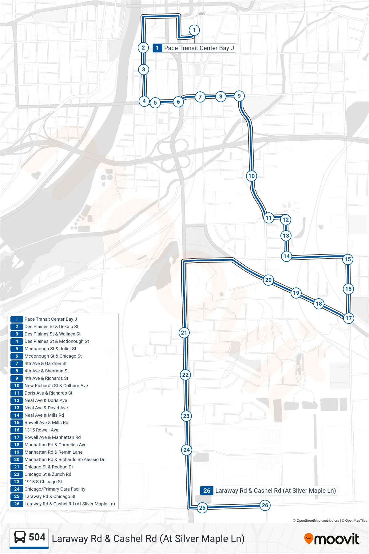
Stops list (504 - Laraway Rd & Cashel Rd (At Silver Maple Ln))
- Pace Transit Center Bay J
- Des Plaines St & Dekalb St
- Des Plaines St & Wallace St
- Des Plaines St & Mcdonough St
- Mcdonough St & Joliet St
- Mcdonough St & Chicago St
- 4th Ave & Gardner St
- 4th Ave & Sherman St
- 4th Ave & Richards St
- New Richards St & Colburn Ave
- Doris Ave & Richards St
- Neal Ave & Doris Ave
- Neal Ave & David Ave
- Neal Ave & Mills Rd
- Rowell Ave & Mills Rd
- 1315 Rowell Ave
- Rowell Ave & Manhattan Rd
- Manhattan Rd & Cornelius Ave
- Manhattan Rd & Remin Lane
- Manhattan Rd & Richards St/Alessio Dr
- Chicago St & Redbud Dr
- Chicago St & Zurich Rd
- 1913 S Chicago St
- Chicago/Primary Care Facility
- Laraway Rd & Chicago St
- Laraway Rd & Cashel Rd (At Silver Maple Ln)