
504 Bus Route Map
View the 504 route map and see all 504 stops along the route. The map of 504 shows where the bus travels and the location of each stop, making it easy to understand the entire route at a glance.
Explore BW routes on the map and see where BW bus services operate. Use the 504 map to find bus stops and see how the 504 connects different areas along its trip.
All 504 stops on the map are displayed in route order, helping you follow the 504 bus from the first stop to the last.
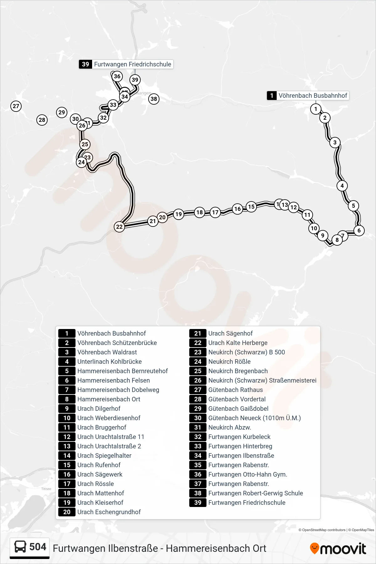
Stops list (504 - Furtwangen Friedrichschule)
- Vöhrenbach Busbahnhof
- Vöhrenbach Schützenbrücke
- Vöhrenbach Waldrast
- Unterlinach Kohlbrücke
- Hammereisenbach Bernreutehof
- Hammereisenbach Felsen
- Hammereisenbach Dobelweg
- Hammereisenbach Ort
- Urach Dilgerhof
- Urach Weberdiesenhof
- Urach Bruggerhof
- Urach Urachtalstraße 11
- Urach Urachtalstraße 2
- Urach Spiegelhalter
- Urach Rufenhof
- Urach Sägewerk
- Urach Rössle
- Urach Mattenhof
- Urach Kleiserhof
- Urach Eschengrundhof
- Urach Sägenhof
- Urach Kalte Herberge
- Neukirch (Schwarzw) B 500
- Neukirch Rößle
- Neukirch Bregenbach
- Neukirch (Schwarzw) Straßenmeisterei
- Gütenbach Rathaus
- Gütenbach Vordertal
- Gütenbach Gaißdobel
- Gütenbach Neueck (1010m Ü.M.)
- Neukirch Abzw.
- Furtwangen Kurbeleck
- Furtwangen Hinterbreg
- Furtwangen Ilbenstraße
- Furtwangen Rabenstr.
- Furtwangen Otto-Hahn Gym.
- Furtwangen Rabenstr.
- Furtwangen Robert-Gerwig Schule
- Furtwangen Friedrichschule
Change direction
- Route Map - 504 - Vöhrenbach Schule
- Route Map - 504 - Furtwangen Ilbenstraße
- Route Map - 504 - Vöhrenbach Schule
- Route Map - 504 - Vöhrenbach Busbahnhof
- Route Map - 504 - Hammereisenbach Ort
- Route Map - 504 - Urach Kalte Herberge
- Route Map - 504 - Neukirch Rößle
- Route Map - 504 - Furtwangen Rößleplatz
- Route Map - 504 - Vöhrenbach Schützenbrücke
- Route Map - 504 - Furtwangen Hinterbreg
- Route Map - 504 - Gütenbach Rathaus