
508 Bus Route Map
View the 508 route map and see all 508 stops along the route. The map of 508 shows where the bus travels and the location of each stop, making it easy to understand the entire route at a glance.
Explore RSVG Rhein-Sieg-Verkehrsgesellschaft mbH routes on the map and see where RSVG Rhein-Sieg-Verkehrsgesellschaft mbH bus services operate. Use the 508 map to find bus stops and see how the 508 connects different areas along its trip.
All 508 stops on the map are displayed in route order, helping you follow the 508 bus from the first stop to the last.
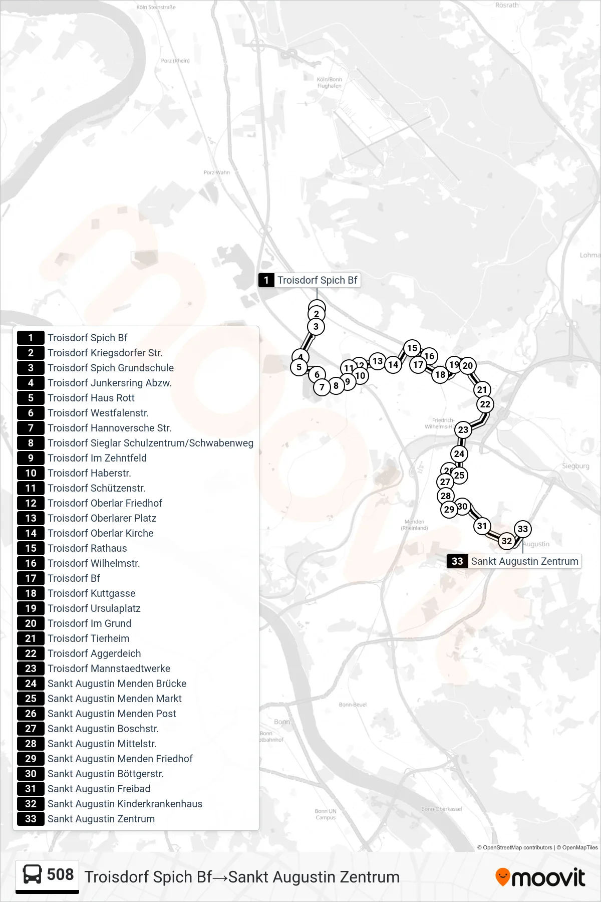
Stops list (508 - Troisdorf Spich Bf→Sankt Augustin Zentrum)
- Troisdorf Spich Bf
- Troisdorf Kriegsdorfer Str.
- Troisdorf Spich Grundschule
- Troisdorf Junkersring Abzw.
- Troisdorf Haus Rott
- Troisdorf Westfalenstr.
- Troisdorf Hannoversche Str.
- Troisdorf Sieglar Schulzentrum/Schwabenweg
- Troisdorf Im Zehntfeld
- Troisdorf Haberstr.
- Troisdorf Schützenstr.
- Troisdorf Oberlar Friedhof
- Troisdorf Oberlarer Platz
- Troisdorf Oberlar Kirche
- Troisdorf Rathaus
- Troisdorf Wilhelmstr.
- Troisdorf Bf
- Troisdorf Kuttgasse
- Troisdorf Ursulaplatz
- Troisdorf Im Grund
- Troisdorf Tierheim
- Troisdorf Aggerdeich
- Troisdorf Mannstaedtwerke
- Sankt Augustin Menden Brücke
- Sankt Augustin Menden Markt
- Sankt Augustin Menden Post
- Sankt Augustin Boschstr.
- Sankt Augustin Mittelstr.
- Sankt Augustin Menden Friedhof
- Sankt Augustin Böttgerstr.
- Sankt Augustin Freibad
- Sankt Augustin Kinderkrankenhaus
- Sankt Augustin Zentrum
Change direction
- Route Map - 508 - Troisdorf Sieglar Schulzentrum/Schwabenweg→Troisdorf Spich Bf
- Route Map - 508 - Sankt Augustin Zentrum→Troisdorf Spich Bf
- Route Map - 508 - Troisdorf Bf→Sankt Augustin Zentrum
- Route Map - 508 - Troisdorf Spich Bf→Troisdorf Sieglar Schulzentrum/Schwabenweg
- Route Map - 508 - Sankt Augustin Zentrum→Troisdorf Bf