
508 Bus Route Map
View the 508 route map and see all 508 stops along the route. The map of 508 shows where the bus travels and the location of each stop, making it easy to understand the entire route at a glance.
Explore Nomad Car (Région Normandie) routes on the map and see where Nomad Car (Région Normandie) bus services operate. Use the 508 map to find bus stops and see how the 508 connects different areas along its trip.
All 508 stops on the map are displayed in route order, helping you follow the 508 bus from the first stop to the last.
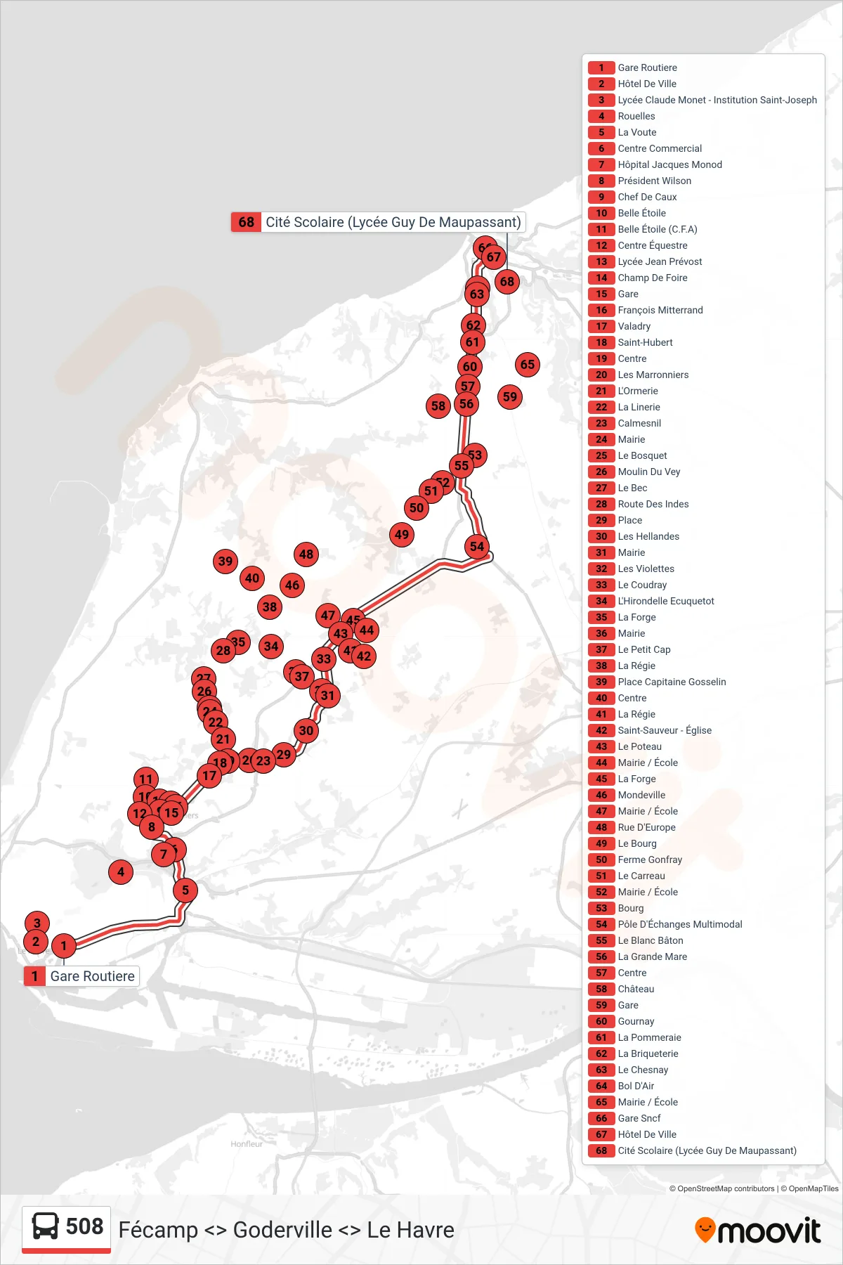
Stops list (508 - Fécamp)
- Gare Routiere
- Hôtel De Ville
- Lycée Claude Monet - Institution Saint-Joseph
- Rouelles
- La Voute
- Centre Commercial
- Hôpital Jacques Monod
- Président Wilson
- Centre Équestre
- Belle Étoile (C.F.A)
- Chef De Caux
- Belle Étoile
- Lycée Jean Prévost
- Champ De Foire
- Gare
- François Mitterrand
- Valadry
- Saint-Hubert
- Centre
- Les Marronniers
- L'Ormerie
- La Linerie
- Mairie
- Le Bosquet
- Moulin Du Vey
- Le Bec
- Calmesnil
- Place
- Les Hellandes
- Route Des Indes
- Mairie
- Les Violettes
- L'Hirondelle Ecuquetot
- La Forge
- Mairie
- Le Petit Cap
- La Régie
- Place Capitaine Gosselin
- Centre
- Le Coudray
- Le Poteau
- La Régie
- Mairie / École
- La Forge
- Mondeville
- Mairie / École
- Saint-Sauveur - Église
- Rue D'Europe
- Le Bourg
- Ferme Gonfray
- Le Carreau
- Mairie / École
- Bourg
- Pôle D'Échanges Multimodal
- Le Blanc Bâton
- La Grande Mare
- Centre
- Château
- Gare
- Mairie / École
- Gournay
- La Pommeraie
- La Briqueterie
- Le Chesnay
- Bol D'Air
- Cité Scolaire (Lycée Guy De Maupassant)
- Hôtel De Ville
- Gare Sncf
- Hôtel De Ville
- René Coty