
51 Bus Route Map
View the 51 route map and see all 51 stops along the route. The map of 51 shows where the bus travels and the location of each stop, making it easy to understand the entire route at a glance.
Explore Aachener Straßenbahn- und Energieversorgungs-AG routes on the map and see where Aachener Straßenbahn- und Energieversorgungs-AG bus services operate. Use the 51 map to find bus stops and see how the 51 connects different areas along its trip.
All 51 stops on the map are displayed in route order, helping you follow the 51 bus from the first stop to the last.
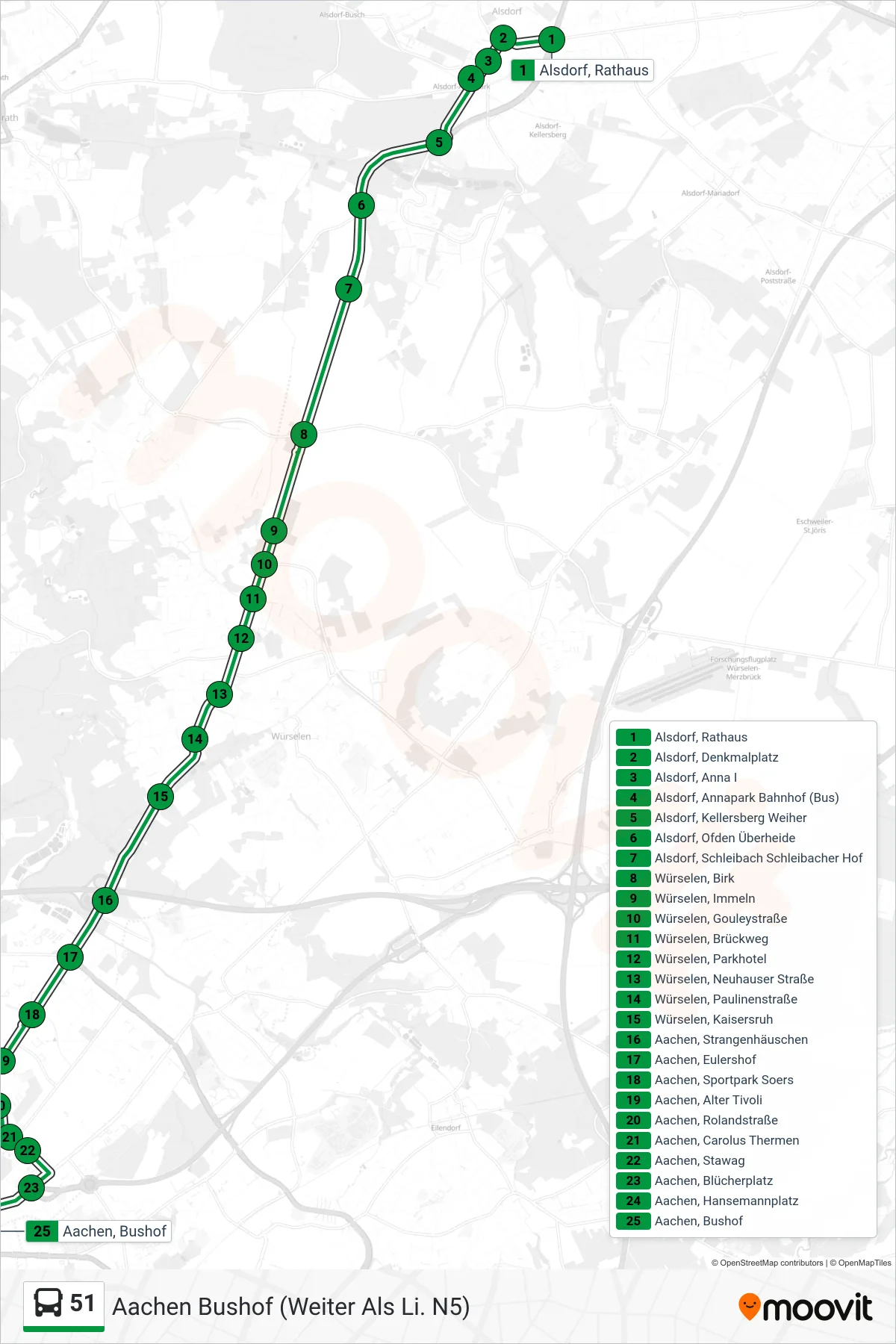
Stops list (51 - Aachen Bushof (Weiter Als Li. N5))
- Alsdorf, Rathaus
- Alsdorf, Denkmalplatz
- Alsdorf, Anna I
- Alsdorf, Annapark Bahnhof (Bus)
- Alsdorf, Kellersberg Weiher
- Alsdorf, Ofden Überheide
- Alsdorf, Schleibach Schleibacher Hof
- Würselen, Birk
- Würselen, Immeln
- Würselen, Gouleystraße
- Würselen, Brückweg
- Würselen, Parkhotel
- Würselen, Neuhauser Straße
- Würselen, Paulinenstraße
- Würselen, Kaisersruh
- Aachen, Strangenhäuschen
- Aachen, Eulershof
- Aachen, Sportpark Soers
- Aachen, Alter Tivoli
- Aachen, Rolandstraße
- Aachen, Carolus Thermen
- Aachen, Stawag
- Aachen, Blücherplatz
- Aachen, Hansemannplatz
- Aachen, Bushof
Change direction
- Route Map - 51 - Siegel
- Route Map - 51 - Aachen, Alter Posthof
- Route Map - 51 - Würselen Parkhotel
- Route Map - 51 - Baesweiler Reyplatz
- Route Map - 51 - Baesweiler, Bushof
- Route Map - 51 - Baesweiler, Setterich Siedlung
- Route Map - 51 - Floverich
- Route Map - 51 - Aachen Bushof (Weiter Als Li. 11)
- Route Map - 51 - Aachen, Siegel
- Route Map - 51 - Aachen Bushof (Weiter Als Li. 21)
- Route Map - 51 - Setterich Siedlung
- Route Map - 51 - Baesweiler Roskaul - Bushof
- Route Map - 51 - Aachen Bushof
- Route Map - 51 - Alsdorf Annapark
- Route Map - 51 - Alter Posthof
- Route Map - 51 - Würselen (Weiter Als Li. 21)
- Route Map - 51 - Alsdorf Gesamtschule
- Route Map - 51 - Aachen Hauptbahnhof
- Route Map - 51 - Alsdorf Denkmalplatz
- Route Map - 51 - Würselen Birk
- Route Map - 51 - Aachen Waldfriedhof
- Route Map - 51 - Sportpark Soers