
511 Bus Route Map
View the 511 route map and see all 511 stops along the route. The map of 511 shows where the bus travels and the location of each stop, making it easy to understand the entire route at a glance.
Explore A.t.a.p. routes on the map and see where A.t.a.p. bus services operate. Use the 511 map to find bus stops and see how the 511 connects different areas along its trip.
All 511 stops on the map are displayed in route order, helping you follow the 511 bus from the first stop to the last.
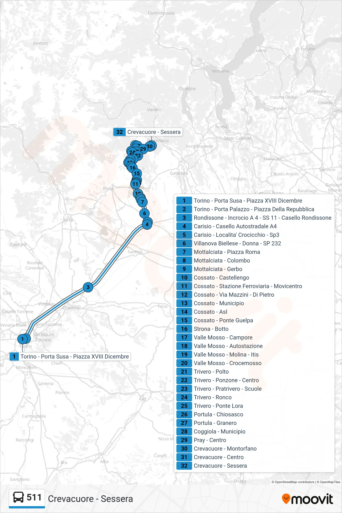
Stops list (511 - Crevacuore - Sessera)
- Turin - Porta Susa - Piazza XVIII December
- Turin - Porta Palazzo - Republic Square
- Rondissone - Intersection A4 - SS 11 - Rondissone Toll
- Carisio - A4 Highway Toll
- Carisio - Crocicchio Locality - SP3
- Villanova Biellese - Donna - SP 232
- Mottalciata - Roma Square
- Mottalciata - Colombo
- Mottalciata - Gerbo
- Cossato - Castellengo
- Cossato - Railway Station - Movicentro
- Cossato - Mazzini Street - Di Pietro
- Cossato - Town Hall
- Cossato - Health Center
- Cossato - Guelpa Bridge
- Strona - Botto
- Valle Mosso - Campore
- Valle Mosso - Bus Station
- Valle Mosso - Molina - ITIS
- Valle Mosso - Crocemosso
- Trivero - Polto
- Trivero - Ponzone - Center
- Trivero - Pratrivero - Schools
- Trivero - Ronco
- Trivero - Ponte Lora
- Portula - Chiosasco
- Portula - Granero
- Coggiola - Town Hall
- Pray - Center
- Crevacuore - Montorfano
- Crevacuore - Center
- Crevacuore - Sessera