
514 Bus Route Map
View the 514 route map and see all 514 stops along the route. The map of 514 shows where the bus travels and the location of each stop, making it easy to understand the entire route at a glance.
Explore HST routes on the map and see where HST bus services operate. Use the 514 map to find bus stops and see how the 514 connects different areas along its trip.
All 514 stops on the map are displayed in route order, helping you follow the 514 bus from the first stop to the last.
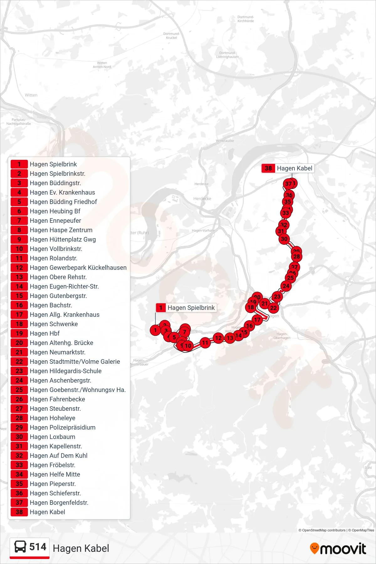
Stops list (514 - Hagen Kabel)
- Hagen Spielbrink
- Hagen Spielbrinkstr.
- Hagen Büddingstr.
- Hagen Ev. Krankenhaus
- Hagen Büdding Friedhof
- Hagen Heubing Bf
- Hagen Ennepeufer
- Hagen Haspe Zentrum
- Hagen Hüttenplatz Gwg
- Hagen Vollbrinkstr.
- Hagen Rolandstr.
- Hagen Gewerbepark Kückelhausen
- Hagen Obere Rehstr.
- Hagen Eugen-Richter-Str.
- Hagen Gutenbergstr.
- Hagen Bachstr.
- Hagen Allg. Krankenhaus
- Hagen Schwenke
- Hagen Hbf
- Hagen Altenhg. Brücke
- Hagen Neumarktstr.
- Hagen Stadtmitte/Volme Galerie
- Hagen Hildegardis-Schule
- Hagen Aschenbergstr.
- Hagen Goebenstr./Wohnungsv Ha.
- Hagen Fahrenbecke
- Hagen Steubenstr.
- Hagen Hoheleye
- Hagen Polizeipräsidium
- Hagen Loxbaum
- Hagen Kapellenstr.
- Hagen Auf Dem Kuhl
- Hagen Fröbelstr.
- Hagen Helfe Mitte
- Hagen Pieperstr.
- Hagen Schieferstr.
- Hagen Borgenfeldstr.
- Hagen Kabel