
518I Bus Route Map
View the 518I route map and see all 518I stops along the route. The map of 518I shows where the bus travels and the location of each stop, making it easy to understand the entire route at a glance.
Explore Transporte Mageli routes on the map and see where Transporte Mageli bus services operate. Use the 518I map to find bus stops and see how the 518I connects different areas along its trip.
All 518I stops on the map are displayed in route order, helping you follow the 518I bus from the first stop to the last.
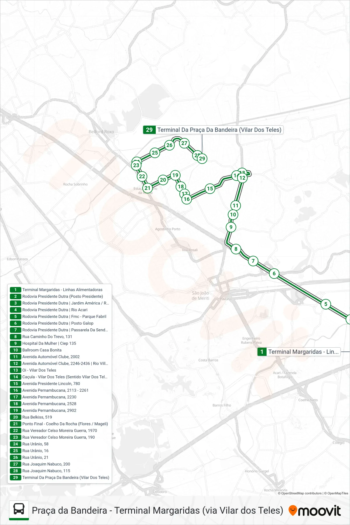
Stops list (518I - Praça da Bandeira)
- Terminal Margaridas - Linhas Alimentadoras
- Rodovia Presidente Dutra (Posto Presidente)
- Rodovia Presidente Dutra | Jardim América / Rua Ministro Artur Costa
- Rodovia Presidente Dutra | Rio Acari
- Rodovia Presidente Dutra | Fmc - Parque Fabril
- Rodovia Presidente Dutra | Posto Galop
- Rodovia Presidente Dutra | Passarela Da Sendas
- Rua Caminho Do Trevo, 131
- Hospital Da Mulher | Ciep 135
- Ballroom Casa Bonita
- Avenida Automóvel Clube, 2002
- Avenida Automóvel Clube, 2246-2436 | Rio Ville Shopping
- Oi - Vilar Dos Teles
- Caçula - Vilar Dos Teles (Sentido Vilar Dos Teles)
- Avenida Presidente Lincoln, 780
- Avenida Pernambucana, 2113 - 2261
- Avenida Pernambucana, 2230
- Avenida Pernambucana, 2528
- Avenida Pernambucana, 2902
- Rua Belkiss, 519
- Ponto Final - Coelho Da Rocha (Flores / Mageli)
- Rua Vereador Celso Moreira Guerra, 1970
- Rua Vereador Celso Moreira Guerra, 190
- Rua Urânio, 58
- Rua Urânio, 16
- Rua Urânio, 21
- Rua Joaquim Nabuco, 200
- Rua Joaquim Nabuco, 115
- Terminal Da Praça Da Bandeira (Vilar Dos Teles)