
52 Bus Route Map
View the 52 route map and see all 52 stops along the route. The map of 52 shows where the bus travels and the location of each stop, making it easy to understand the entire route at a glance.
Explore De Lijn routes on the map and see where De Lijn bus services operate. Use the 52 map to find bus stops and see how the 52 connects different areas along its trip.
All 52 stops on the map are displayed in route order, helping you follow the 52 bus from the first stop to the last.
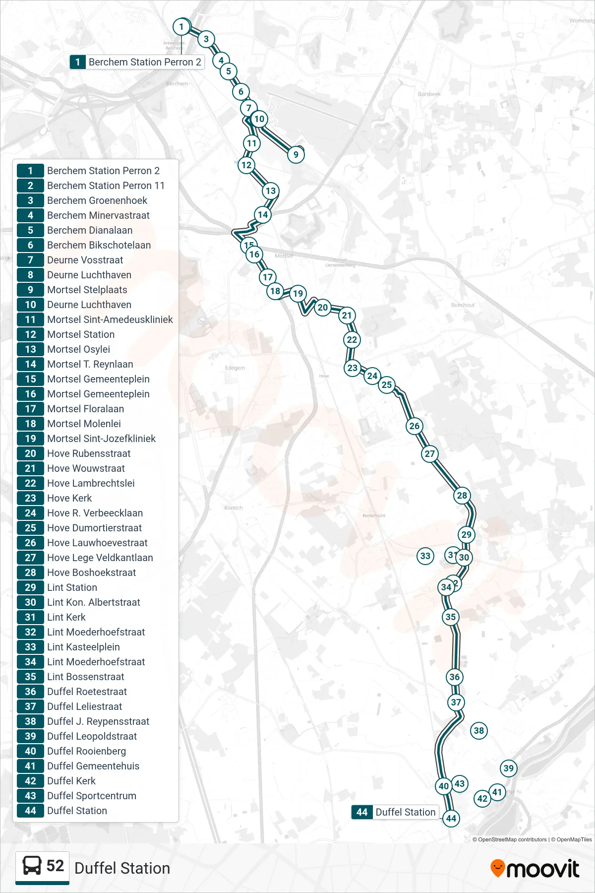
Stops list (52 - Duffel Station)
- Berchem Station Platform 2
- Berchem Station Platform 11
- Berchem Groenenhoek
- Berchem Minerva Street
- Berchem Diana Avenue
- Berchem Bikschotel Avenue
- Deurne Fox Street
- Deurne Airport
- Mortsel Stelplaats
- Deurne Airport
- Mortsel Saint Amedeus Clinic
- Mortsel Station
- Mortsel Osy Avenue
- Mortsel T. Reynlaan
- Mortsel Town Square
- Mortsel Town Square
- Mortsel Flora Avenue
- Mortsel Molen Avenue
- Mortsel St. Joseph Hospital
- Hove Rubens Street
- Hove Wouw Street
- Hove Lambrechtslei
- Hove Church
- Hove Verbeecklaan Street
- Hove Dumortier Street
- Hove Lauwhove Street
- Hove Lege Veldkantlaan
- Hove Forest Corner Street
- Lint Station
- Lint King Albert Street
- Lint Church
- Lint Mother Farm Street
- Lint Castle Square
- Lint Mother Farm Street
- Lint Forest Street
- Duffel Roete Street
- Duffel Lily Street
- Duffel J. Reypens Street
- Duffel Leopold Street
- Duffel Rooienberg
- Duffel Town Hall
- Duffel Church
- Duffel Sports Center
- Duffel Station