
52 Bus Route Map
View the 52 route map and see all 52 stops along the route. The map of 52 shows where the bus travels and the location of each stop, making it easy to understand the entire route at a glance.
Explore HLB Hessenbus Kassel routes on the map and see where HLB Hessenbus Kassel bus services operate. Use the 52 map to find bus stops and see how the 52 connects different areas along its trip.
All 52 stops on the map are displayed in route order, helping you follow the 52 bus from the first stop to the last.
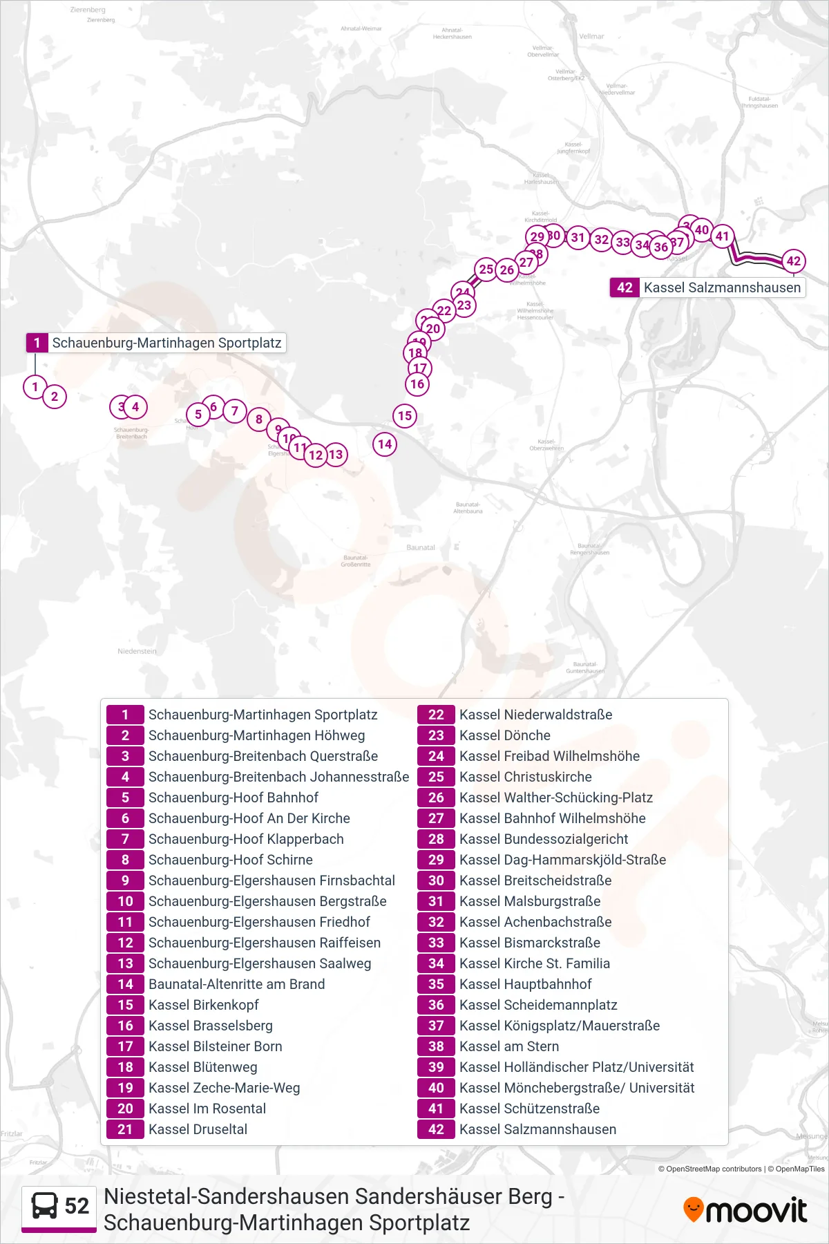
Stops list (52 - Salzmannshausen)
- Schauenburg-Martinhagen Sportplatz
- Schauenburg-Martinhagen Höhweg
- Schauenburg-Breitenbach Querstraße
- Schauenburg-Breitenbach Johannesstraße
- Schauenburg-Hoof Bahnhof
- Schauenburg-Hoof An Der Kirche
- Schauenburg-Hoof Klapperbach
- Schauenburg-Hoof Schirne
- Schauenburg-Elgershausen Firnsbachtal
- Schauenburg-Elgershausen Bergstraße
- Schauenburg-Elgershausen Friedhof
- Schauenburg-Elgershausen Raiffeisen
- Schauenburg-Elgershausen Saalweg
- Baunatal-Altenritte am Brand
- Kassel Birkenkopf
- Kassel Brasselsberg
- Kassel Bilsteiner Born
- Kassel Blütenweg
- Kassel Zeche-Marie-Weg
- Kassel Im Rosental
- Kassel Druseltal
- Kassel Niederwaldstraße
- Kassel Dönche
- Kassel Freibad Wilhelmshöhe
- Kassel Christuskirche
- Kassel Walther-Schücking-Platz
- Kassel Bahnhof Wilhelmshöhe
- Kassel Bundessozialgericht
- Kassel Dag-Hammarskjöld-Straße
- Kassel Breitscheidstraße
- Kassel Malsburgstraße
- Kassel Achenbachstraße
- Kassel Bismarckstraße
- Kassel Kirche St. Familia
- Kassel Hauptbahnhof
- Kassel Scheidemannplatz
- Kassel Königsplatz/Mauerstraße
- Kassel am Stern
- Kassel Holländischer Platz/Universität
- Kassel Mönchebergstraße/ Universität
- Kassel Schützenstraße
- Kassel Salzmannshausen