
52 Bus Route Map
View the 52 route map and see all 52 stops along the route. The map of 52 shows where the bus travels and the location of each stop, making it easy to understand the entire route at a glance.
Explore NJ Transit routes on the map and see where NJ Transit bus services operate. Use the 52 map to find bus stops and see how the 52 connects different areas along its trip.
All 52 stops on the map are displayed in route order, helping you follow the 52 bus from the first stop to the last.
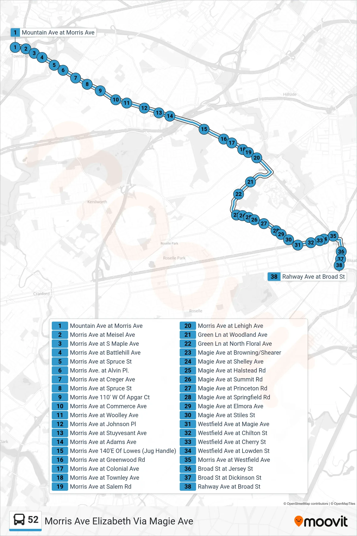
Stops list (52 - Morris Ave Elizabeth Via Magie Ave)
- Mountain Ave at Morris Ave
- Morris Ave at Meisel Ave
- Morris Ave at S Maple Ave
- Morris Ave at Battlehill Ave
- Morris Ave at Spruce St
- Morris Ave. at Alvin Pl.
- Morris Ave at Creger Ave
- Morris Ave at Spruce St
- Morris Ave 110' W Of Apgar Ct
- Morris Ave at Commerce Ave
- Morris Ave at Woolley Ave
- Morris Ave at Johnson Pl
- Morris Ave at Stuyvesant Ave
- Morris Ave at Adams Ave
- Morris Ave 140'E Of Lowes (Jug Handle)
- Morris Ave at Greenwood Rd
- Morris Ave at Colonial Ave
- Morris Ave at Townley Ave
- Morris Ave at Salem Rd
- Morris Ave at Lehigh Ave
- Green Ln at Woodland Ave
- Green Ln at North Floral Ave
- Magie Ave at Browning/Shearer
- Magie Ave at Shelley Ave
- Magie Ave at Halstead Rd
- Magie Ave at Summit Rd
- Magie Ave at Princeton Rd
- Magie Ave at Springfield Rd
- Magie Ave at Elmora Ave
- Magie Ave at Stiles St
- Westfield Ave at Magie Ave
- Westfield Ave at Chilton St
- Westfield Ave at Cherry St
- Westfield Ave at Lowden St
- Morris Ave at Westfield Ave
- Broad St at Jersey St
- Broad St at Dickinson St
- Rahway Ave at Broad St