
52 Bus Route Map
View the 52 route map and see all 52 stops along the route. The map of 52 shows where the bus travels and the location of each stop, making it easy to understand the entire route at a glance.
Explore Niederrheinische VKB routes on the map and see where Niederrheinische VKB bus services operate. Use the 52 map to find bus stops and see how the 52 connects different areas along its trip.
All 52 stops on the map are displayed in route order, helping you follow the 52 bus from the first stop to the last.
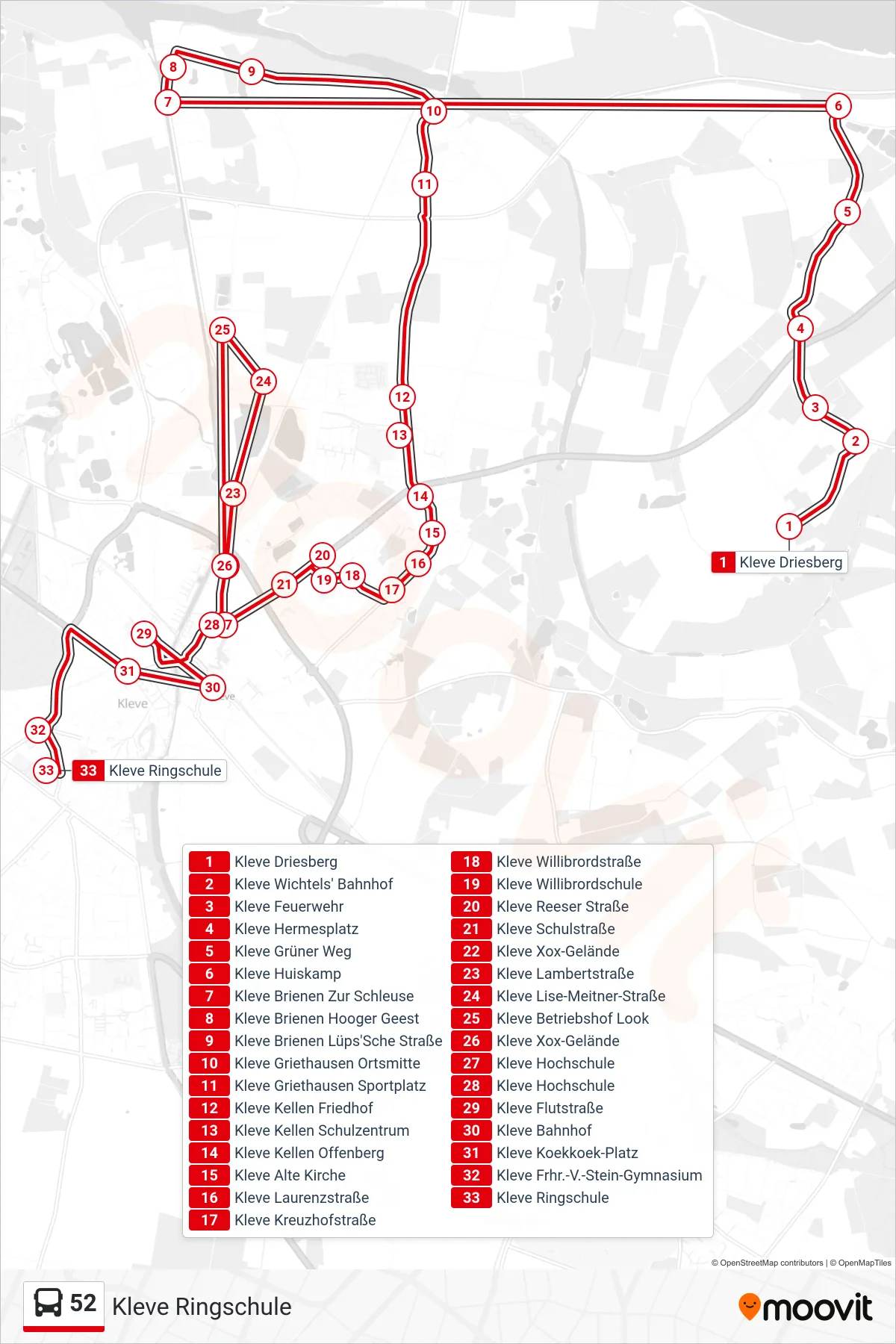
Stops list (52 - Kleve Ringschule)
- Kleve Driesberg
- Kleve Wichtels' Bahnhof
- Kleve Feuerwehr
- Kleve Hermesplatz
- Kleve Grüner Weg
- Kleve Huiskamp
- Kleve Brienen Zur Schleuse
- Kleve Brienen Hooger Geest
- Kleve Brienen Lüps'Sche Straße
- Kleve Griethausen Ortsmitte
- Kleve Griethausen Sportplatz
- Kleve Kellen Friedhof
- Kleve Kellen Schulzentrum
- Kleve Kellen Offenberg
- Kleve Alte Kirche
- Kleve Laurenzstraße
- Kleve Kreuzhofstraße
- Kleve Willibrordstraße
- Kleve Willibrordschule
- Kleve Reeser Straße
- Kleve Schulstraße
- Kleve Xox-Gelände
- Kleve Lambertstraße
- Kleve Lise-Meitner-Straße
- Kleve Betriebshof Look
- Kleve Xox-Gelände
- Kleve Hochschule
- Kleve Hochschule
- Kleve Flutstraße
- Kleve Bahnhof
- Kleve Koekkoek-Platz
- Kleve Frhr.-V.-Stein-Gymnasium
- Kleve Ringschule