
52 Bus Route Map
View the 52 route map and see all 52 stops along the route. The map of 52 shows where the bus travels and the location of each stop, making it easy to understand the entire route at a glance.
Explore PRTC routes on the map and see where PRTC bus services operate. Use the 52 map to find bus stops and see how the 52 connects different areas along its trip.
All 52 stops on the map are displayed in route order, helping you follow the 52 bus from the first stop to the last.
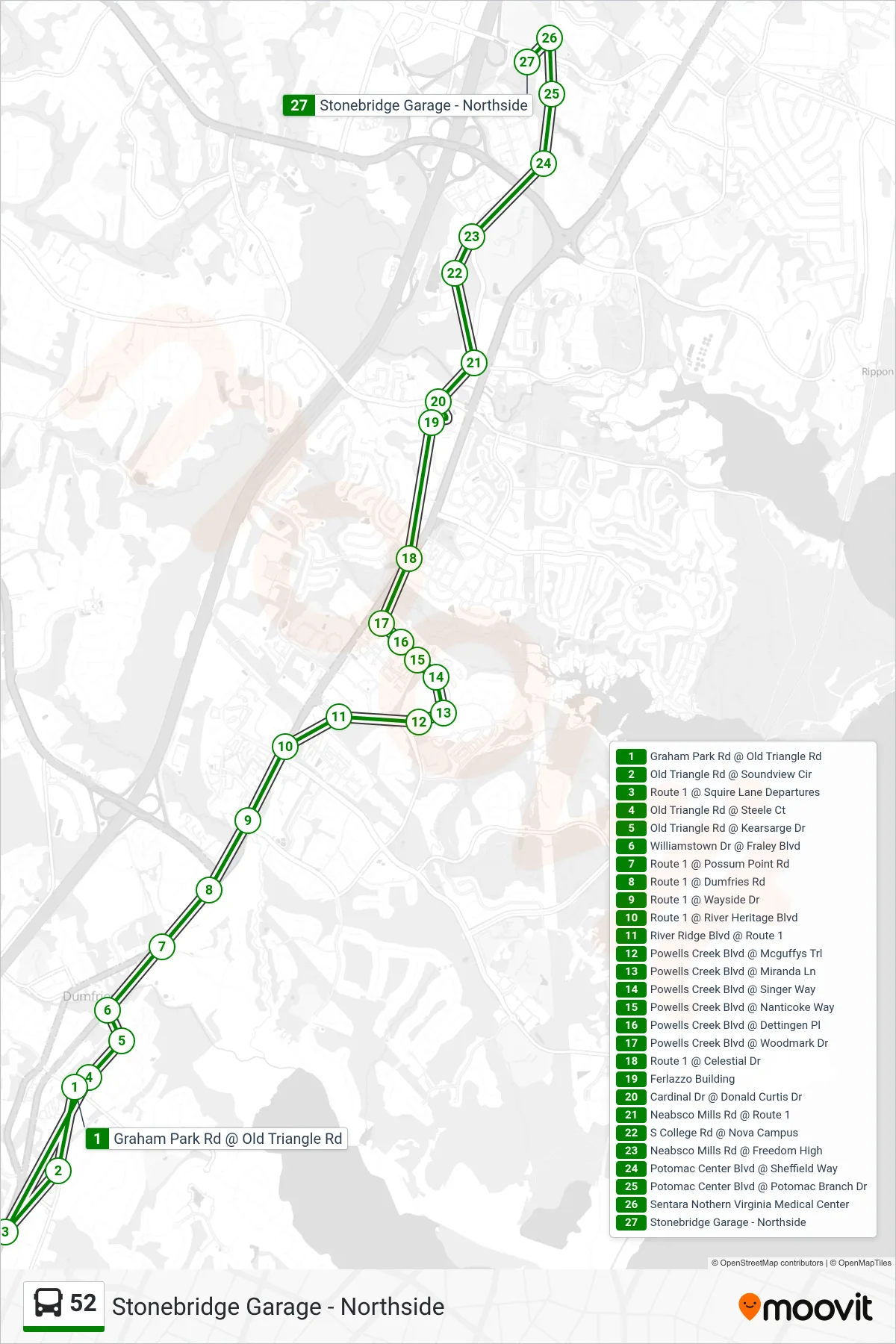
Stops list (52 - Stonebridge Garage - Northside)
- Graham Park Rd @ Old Triangle Rd
- Old Triangle Rd @ Soundview Cir
- Route 1 @ Squire Lane Departures
- Old Triangle Rd @ Steele Ct
- Old Triangle Rd @ Kearsarge Dr
- Williamstown Dr @ Fraley Blvd
- Route 1 @ Possum Point Rd
- Route 1 @ Dumfries Rd
- Route 1 @ Wayside Dr
- Route 1 @ River Heritage Blvd
- River Ridge Blvd @ Route 1
- Powells Creek Blvd @ Mcguffys Trl
- Powells Creek Blvd @ Miranda Ln
- Powells Creek Blvd @ Singer Way
- Powells Creek Blvd @ Nanticoke Way
- Powells Creek Blvd @ Dettingen Pl
- Powells Creek Blvd @ Woodmark Dr
- Route 1 @ Celestial Dr
- Ferlazzo Building
- Cardinal Dr @ Donald Curtis Dr
- Neabsco Mills Rd @ Route 1
- S College Rd @ Nova Campus
- Neabsco Mills Rd @ Freedom High
- Potomac Center Blvd @ Sheffield Way
- Potomac Center Blvd @ Potomac Branch Dr
- Sentara Nothern Virginia Medical Center
- Stonebridge Garage - Northside