
520 Bus Route Map
View the 520 route map and see all 520 stops along the route. The map of 520 shows where the bus travels and the location of each stop, making it easy to understand the entire route at a glance.
Explore Verkehrsverbund Elbe Elster routes on the map and see where Verkehrsverbund Elbe Elster bus services operate. Use the 520 map to find bus stops and see how the 520 connects different areas along its trip.
All 520 stops on the map are displayed in route order, helping you follow the 520 bus from the first stop to the last.
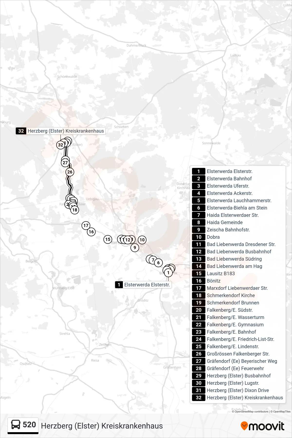
Stops list (520 - Herzberg (Elster) Kreiskrankenhaus)
- Elsterwerda Elsterstr.
- Elsterwerda Bahnhof
- Elsterwerda Uferstr.
- Elsterwerda Ackerstr.
- Elsterwerda Lauchhammerstr.
- Elsterwerda-Biehla am Stein
- Haida Elsterwerdaer Str.
- Haida Gemeinde
- Zeischa Bahnhofstr.
- Dobra
- Bad Liebenwerda Dresdener Str.
- Bad Liebenwerda Busbahnhof
- Bad Liebenwerda Südring
- Bad Liebenwerda am Hag
- Lausitz B183
- Bönitz
- Marxdorf Liebenwerdaer Str.
- Schmerkendorf Kirche
- Schmerkendorf Brunnen
- Falkenberg/E. Südstr.
- Falkenberg/E. Wasserturm
- Falkenberg/E. Gymnasium
- Falkenberg/E. Bahnhof
- Falkenberg/E. Friedrich-List-Str.
- Falkenberg/E. Lindenstr.
- Großrössen Falkenberger Str.
- Gräfendorf (Ee) Beyerischer Weg
- Gräfendorf (Ee) Feuerwehr
- Herzberg (Elster) Busbahnhof
- Herzberg (Elster) Lugstr.
- Herzberg (Elster) Dixon Drive
- Herzberg (Elster) Kreiskrankenhaus
Change direction
- Route Map - 520 - Elsterwerda Bahnhof
- Route Map - 520 - Bad Liebenwerda Busbahnhof
- Route Map - 520 - Herzberg (Elster) Busbahnhof
- Route Map - 520 - Falkenberg/E. Bahnhof
- Route Map - 520 - Herzberg (Elster) Kreiskrankenhaus
- Route Map - 520 - Bad Liebenwerda Busbahnhof
- Route Map - 520 - Elsterwerda Elsterstr.
- Route Map - 520 - Herzberg (Elster) Grund- Und Oberschule
- Route Map - 520 - Kleinrössen