
520 Bus Route Map
View the 520 route map and see all 520 stops along the route. The map of 520 shows where the bus travels and the location of each stop, making it easy to understand the entire route at a glance.
Explore Nomad Car (Région Normandie) routes on the map and see where Nomad Car (Région Normandie) bus services operate. Use the 520 map to find bus stops and see how the 520 connects different areas along its trip.
All 520 stops on the map are displayed in route order, helping you follow the 520 bus from the first stop to the last.
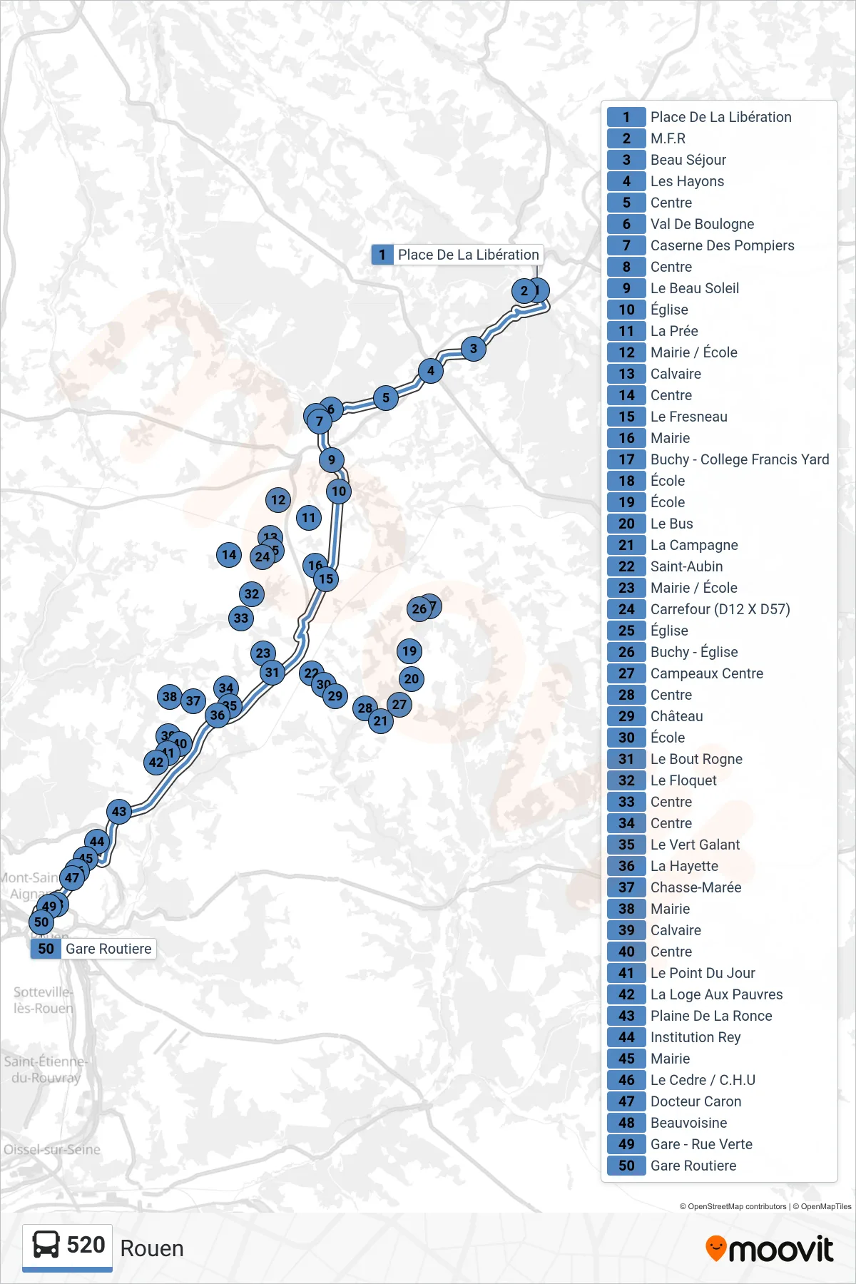
Stops list (520 - Rouen)
- Place De La Libération
- M.F.R
- Beau Séjour
- Les Hayons
- Centre
- Val De Boulogne
- Caserne Des Pompiers
- Centre
- Le Beau Soleil
- Église
- La Prée
- Mairie / École
- Calvaire
- Centre
- Le Fresneau
- Mairie
- Buchy - College Francis Yard
- École
- École
- Le Bus
- La Campagne
- Saint-Aubin
- Mairie / École
- Carrefour (D12 X D57)
- Église
- Buchy - Église
- Campeaux Centre
- Centre
- Château
- École
- Le Bout Rogne
- Le Floquet
- Centre
- Centre
- Le Vert Galant
- La Hayette
- Chasse-Marée
- Mairie
- Calvaire
- Centre
- Le Point Du Jour
- La Loge Aux Pauvres
- Plaine De La Ronce
- Institution Rey
- Mairie
- Le Cedre / C.H.U
- Docteur Caron
- Beauvoisine
- Gare - Rue Verte
- Gare Routiere
Change direction
- Route Map - 520 - Saint-André-Sur-Cailly
- Route Map - 520 - Esteville
- Route Map - 520 - Buchy
- Route Map - 520 - Quincampoix
- Route Map - 520 - Saint-Martin-Osmonville
- Route Map - 520 - La Rue-Saint-Pierre
- Route Map - 520 - Cailly
- Route Map - 520 - Neufchâtel-En-Bray
- Route Map - 520 - Saint-Saëns
- Route Map - 520 - Saint-Germain-Sous-Cailly