
529 Bus Route Map
View the 529 route map and see all 529 stops along the route. The map of 529 shows where the bus travels and the location of each stop, making it easy to understand the entire route at a glance.
Explore Nomad Car (Région Normandie) routes on the map and see where Nomad Car (Région Normandie) bus services operate. Use the 529 map to find bus stops and see how the 529 connects different areas along its trip.
All 529 stops on the map are displayed in route order, helping you follow the 529 bus from the first stop to the last.
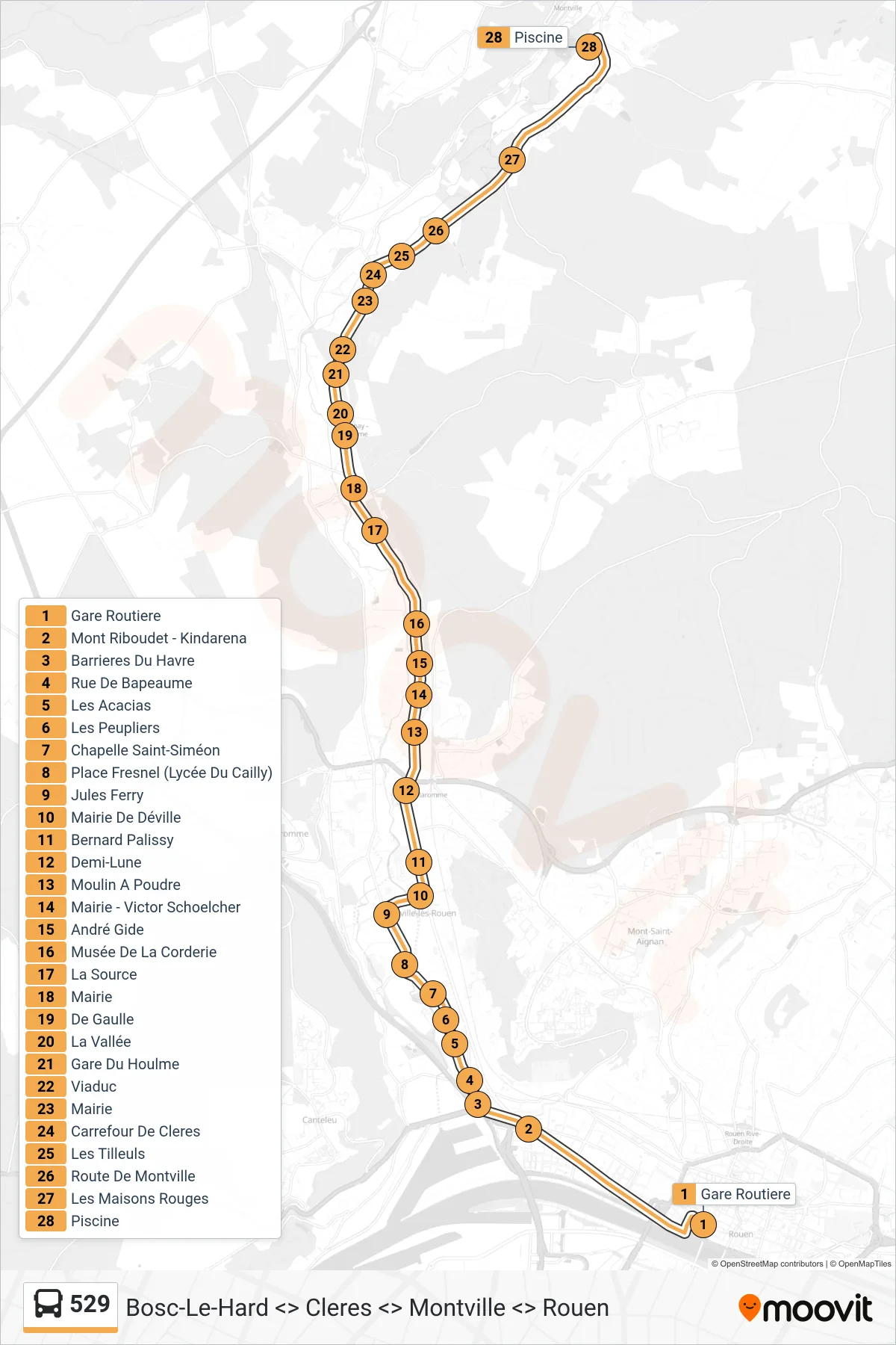
Stops list (529 - Montville)
- Gare Routiere
- Mont Riboudet - Kindarena
- Barrieres Du Havre
- Rue De Bapeaume
- Les Acacias
- Les Peupliers
- Chapelle Saint-Siméon
- Place Fresnel (Lycée Du Cailly)
- Jules Ferry
- Mairie De Déville
- Bernard Palissy
- Demi-Lune
- Moulin A Poudre
- Mairie - Victor Schoelcher
- André Gide
- Musée De La Corderie
- La Source
- Mairie
- De Gaulle
- La Vallée
- Gare Du Houlme
- Viaduc
- Mairie
- Carrefour De Cleres
- Les Tilleuls
- Route De Montville
- Les Maisons Rouges
- Piscine