
530 Bus Route Map
View the 530 route map and see all 530 stops along the route. The map of 530 shows where the bus travels and the location of each stop, making it easy to understand the entire route at a glance.
Explore Nomad Car (Région Normandie) routes on the map and see where Nomad Car (Région Normandie) bus services operate. Use the 530 map to find bus stops and see how the 530 connects different areas along its trip.
All 530 stops on the map are displayed in route order, helping you follow the 530 bus from the first stop to the last.
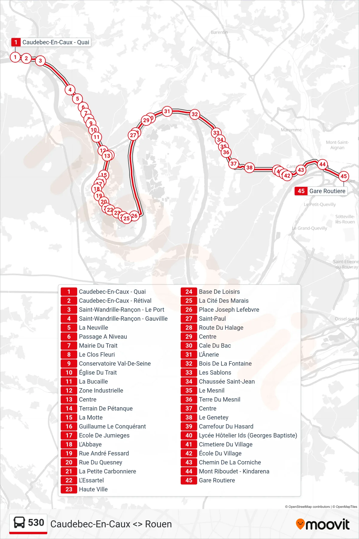
Stops list (530 - Rouen)
- Caudebec-En-Caux - Quai
- Caudebec-En-Caux - Rétival
- Saint-Wandrille-Rançon - Le Port
- Saint-Wandrille-Rançon - Gauvillle
- La Neuville
- Passage A Niveau
- Mairie Du Trait
- Le Clos Fleuri
- Conservatoire Val-De-Seine
- Église Du Trait
- La Bucaille
- Zone Industrielle
- Centre
- Terrain De Pétanque
- La Motte
- Guillaume Le Conquérant
- Ecole De Jumieges
- L'Abbaye
- Rue André Fessard
- Rue Du Quesney
- La Petite Carbonniere
- L'Essartel
- Haute Ville
- Base De Loisirs
- La Cité Des Marais
- Place Joseph Lefebvre
- Saint-Paul
- Route Du Halage
- Centre
- Cale Du Bac
- L'Ânerie
- Bois De La Fontaine
- Les Sablons
- Chaussée Saint-Jean
- Le Mesnil
- Terre Du Mesnil
- Centre
- Le Genetey
- Carrefour Du Hasard
- Lycée Hôtelier Ids (Georges Baptiste)
- Cimetiere Du Village
- École Du Village
- Chemin De La Corniche
- Mont Riboudet - Kindarena
- Gare Routiere