
531 Bus Route Map
View the 531 route map and see all 531 stops along the route. The map of 531 shows where the bus travels and the location of each stop, making it easy to understand the entire route at a glance.
Explore Stern & Hafferl Kraftfahrlinien GmbH routes on the map and see where Stern & Hafferl Kraftfahrlinien GmbH bus services operate. Use the 531 map to find bus stops and see how the 531 connects different areas along its trip.
All 531 stops on the map are displayed in route order, helping you follow the 531 bus from the first stop to the last.
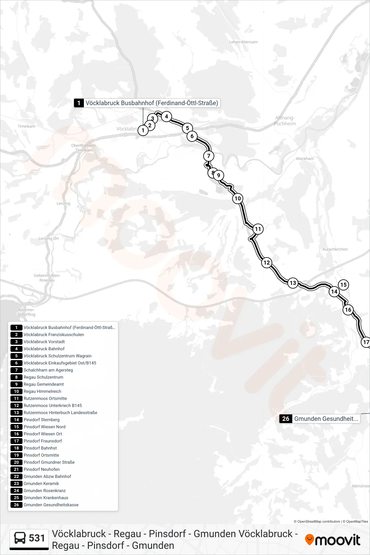
Stops list (531 - Gmunden Gesundheitskasse)
- Vöcklabruck Busbahnhof (Ferdinand-Öttl-Straße)
- Vöcklabruck Franziskusschulen
- Vöcklabruck Vorstadt
- Vöcklabruck Bahnhof
- Vöcklabruck Schulzentrum Wagrain
- Vöcklabruck Einkaufsgebiet Ost/B145
- Schalchham am Agersteg
- Regau Schulzentrum
- Regau Gemeindeamt
- Regau Himmelreich
- Rutzenmoos Ortsmitte
- Rutzenmoos Unterkriech B145
- Rutzenmoos Hinterbuch Landesstraße
- Pinsdorf Sternberg
- Pinsdorf Wiesen Nord
- Pinsdorf Wiesen Ort
- Pinsdorf Fraunsdorf
- Pinsdorf Bahnhst
- Pinsdorf Ortsmitte
- Pinsdorf Gmundner Straße
- Pinsdorf Neuhofen
- Gmunden Abzw Bahnhof
- Gmunden Keramik
- Gmunden Rosenkranz
- Gmunden Krankenhaus
- Gmunden Gesundheitskasse
Change direction
- Route Map - 531 - Vöcklabruck Krankenhaus
- Route Map - 531 - Gmunden Keramik
- Route Map - 531 - Vöcklabruck Franziskusschulen
- Route Map - 531 - Vöcklabruck Schulzentrum Wagrain
- Route Map - 531 - Gmunden Wunderburgstraße
- Route Map - 531 - Pinsdorf Wiesen Nord
- Route Map - 531 - Vöcklabruck Busbahnhof (Ferdinand-Öttl-Straße)
- Route Map - 531 - Gmunden Keramik/Kraftwerkgasse
- Route Map - 531 - Pinsdorf Bahnhst
- Route Map - 531 - Rutzenmoos Hinterbuch Landesstraße
- Route Map - 531 - Gmunden Busbahnhof (Kirchenplatz)
- Route Map - 531 - Gmunden Bahnhof
- Route Map - 531 - Vöcklabruck Bahnhof