
54 Bus Route Map
View the 54 route map and see all 54 stops along the route. The map of 54 shows where the bus travels and the location of each stop, making it easy to understand the entire route at a glance.
Explore Rhode Island Public Transit Authority routes on the map and see where Rhode Island Public Transit Authority bus services operate. Use the 54 map to find bus stops and see how the 54 connects different areas along its trip.
All 54 stops on the map are displayed in route order, helping you follow the 54 bus from the first stop to the last.
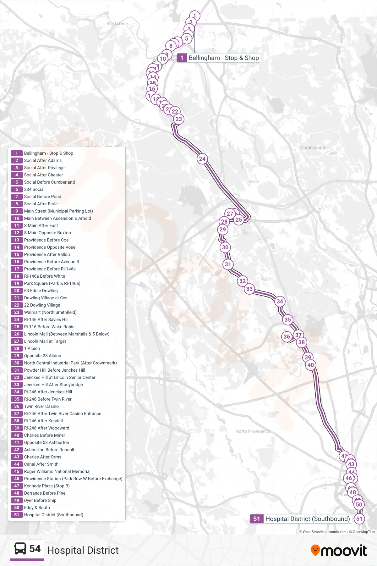
Stops list (54 - Hospital District)
- Bellingham - Stop & Shop
- Social After Adams
- Social After Privilege
- Social After Chester
- Social Before Cumberland
- 334 Social
- Social Before Pond
- Social After Earle
- Main Street (Municipal Parking Lot)
- Main Between Ascension & Arnold
- S Main After East
- S Main Opposite Buxton
- Providence Before Coe
- Providence Opposite Vose
- Providence After Ballou
- Providence Before Avenue B
- Providence Before Ri-146a
- Ri-146a Before White
- Park Square (Park & Ri-146a)
- 63 Eddie Dowling
- Dowling Village at Cvs
- 22 Dowling Village
- Walmart (North Smithfield)
- Ri-146 After Sayles Hill
- Ri-116 Before Wake Robin
- Lincoln Mall (Between Marshalls & 5 Below)
- Lincoln Mall at Target
- 1 Albion
- Opposite 28 Albion
- North Central Industrial Park (After Crownmark)
- Powder Hill Before Jenckes Hill
- Jenckes Hill at Lincoln Senior Center
- Jenckes Hill After Stonybridge
- Ri-246 After Jenckes Hill
- Ri-246 Before Twin River
- Twin River Casino
- Ri-246 After Twin River Casino Entrance
- Ri-246 After Kendall
- Ri-246 After Woodward
- Charles Before Miner
- Opposite 53 Ashburton
- Ashburton Before Randall
- Charles After Orms
- Canal After Smith
- Roger Williams National Memorial
- Providence Station (Park Row W Before Exchange)
- Kennedy Plaza (Stop B)
- Dorrance Before Pine
- Dyer Before Ship
- Eddy & South
- Hospital District (Southbound)