
54 Bus Route Map
View the 54 route map and see all 54 stops along the route. The map of 54 shows where the bus travels and the location of each stop, making it easy to understand the entire route at a glance.
Explore Egged routes on the map and see where Egged bus services operate. Use the 54 map to find bus stops and see how the 54 connects different areas along its trip.
All 54 stops on the map are displayed in route order, helping you follow the 54 bus from the first stop to the last.
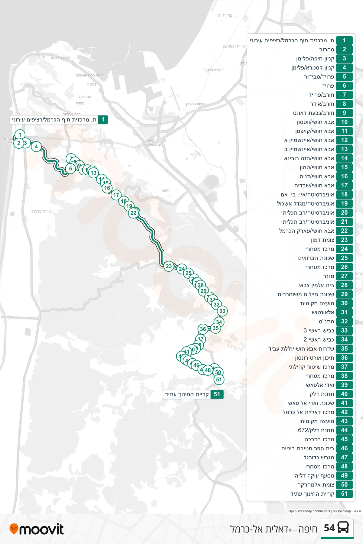
Stops list (54 - Haifa→Daliyat al-Karmel)
- Haifa Hof HaCarmel Central Station/Urban Platforms
- Sokolov
- Haifa Mall/Fliman
- Castra Mall/Pliman
- Freud/Savidor
- Freud
- Horev/Freud
- Horev/Idar
- Horev/Downs Hill
- Abba Khoushy/Watson
- Abba Hushi/Kaufmann
- Abba Khoushy/Einstein A
- Abba Khoushy/Einstein B
- Abba Hushi/Hanna Rovina
- Abba Hushi/Tahon
- Abba Hushi/Denia
- Abba Khoushy/Sweden
- University/IBM
- University/Eshkol Tower
- University/Multi-Purpose
- University/Multi-Purpose
- Abba Khoushy/Carmel Park
- Damon Junction
- Commercial Center
- Bedouin Quarter
- Commercial Center
- Monastery
- Military Cemetery
- Released Soldiers Neighborhood
- Local Council
- Al-Untush
- Community Center
- Main Road 3
- Main Road 2
- Abba Khushi Boulevard/Khalat Abed
- Ort Ronson High School
- Community Police Center
- Commercial Center
- Wadi Al-Fash
- Gas Station
- Wadi al-Fash Neighborhood
- Daliat El Carmel Center
- Local Council
- Gas Station/672
- Training Center
- Middle School
- Soccer Field
- Commercial Center
- Dalia Bypass Junction
- Al-Mahrakah Junction
- Atid Education Campus