
54 Bus Route Map
View the 54 route map and see all 54 stops along the route. The map of 54 shows where the bus travels and the location of each stop, making it easy to understand the entire route at a glance.
Explore Dan routes on the map and see where Dan bus services operate. Use the 54 map to find bus stops and see how the 54 connects different areas along its trip.
All 54 stops on the map are displayed in route order, helping you follow the 54 bus from the first stop to the last.
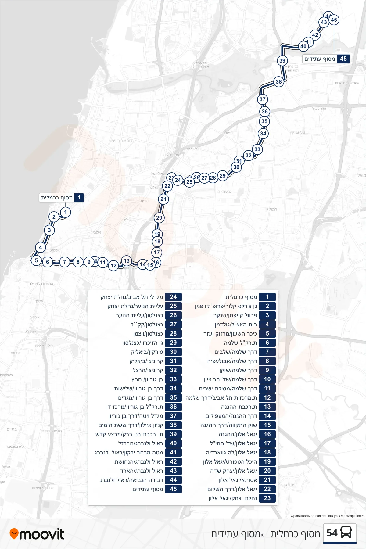
Stops list (54 - Carmelit Terminal→Atidim Terminal)
- Carmelit Terminal
- Charles Clore Park/Prof. Kaufmann
- Prof. Kaufmann/Shenkar
- Etzel House/Goldman
- Clock Square/Marzuk and Ezer
- Light Rail Station Shlomo
- Derech Shlomo/Shlavim
- Derech Shlomo/Abulefia
- Derech Shlomo/Shoken
- Derech Shlomo/Har Zion Blvd
- Shlomo Road/Mesilat Yesharim
- Tel Aviv Central Station/Shlomo Road
- HaHagana Railway Station
- HaHagana Road/HaMa'apilim
- Hatikva Market/HaHagana Road
- Yigal Alon/HaHagana
- Yigal Alon/HaChayil Blvd
- Yigal Alon/La Guardia
- Sports Center/Yigal Allon
- Yigal Alon/Yitzhak Sadeh
- Assuta/Yigal Alon
- Yigal Alon/Derech HaShalom
- Nachalat Yitzhak/Yigal Alon
- Tel Aviv Towers/Nachalat Yitzhak
- Aliyat HaNoar/Nachalat Yitzhak
- Katznelson/Aliyat HaNoar
- Katznelson/KKL
- Katznelson/Weizmann
- Memorial Garden/Katznelson
- Sirkin/Bialik
- Krinitzi/Bialik
- Krinitzi/Herzl
- Ben Gurion/HaChetz
- Ben Gurion Road/Shlishut
- Ben Gurion Road/Megadim
- Ben Gurion Light Rail Station/Dan Center
- Vita Tower/Ben Gurion Road
- Ayalon Mall/Six Day War Road
- Bnei Brak Railway Station/Mivtza Kadesh
- Raoul Wallenberg/HaBarzel
- Yarkon District HQ/Raoul Wallenberg
- Raoul Wallenberg/HaNechoshet
- Raoul Wallenberg/Hard
- Devorah HaNeviah/Raoul Wallenberg
- Atidim Terminal