
54 Bus Route Map
View the 54 route map and see all 54 stops along the route. The map of 54 shows where the bus travels and the location of each stop, making it easy to understand the entire route at a glance.
Explore Omnibusbetrieb Heuser GmbH routes on the map and see where Omnibusbetrieb Heuser GmbH bus services operate. Use the 54 map to find bus stops and see how the 54 connects different areas along its trip.
All 54 stops on the map are displayed in route order, helping you follow the 54 bus from the first stop to the last.
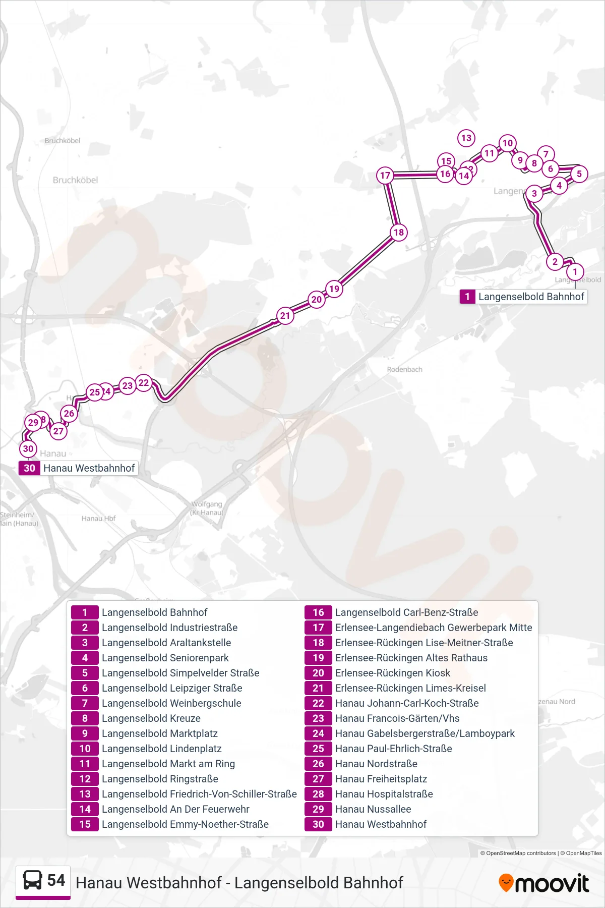
Stops list (54 - Hanau Westbahnhof)
- Langenselbold Bahnhof
- Langenselbold Industriestraße
- Langenselbold Araltankstelle
- Langenselbold Seniorenpark
- Langenselbold Simpelvelder Straße
- Langenselbold Leipziger Straße
- Langenselbold Weinbergschule
- Langenselbold Kreuze
- Langenselbold Marktplatz
- Langenselbold Lindenplatz
- Langenselbold Markt am Ring
- Langenselbold Ringstraße
- Langenselbold Friedrich-Von-Schiller-Straße
- Langenselbold An Der Feuerwehr
- Langenselbold Emmy-Noether-Straße
- Langenselbold Carl-Benz-Straße
- Erlensee-Langendiebach Gewerbepark Mitte
- Erlensee-Rückingen Lise-Meitner-Straße
- Erlensee-Rückingen Altes Rathaus
- Erlensee-Rückingen Kiosk
- Erlensee-Rückingen Limes-Kreisel
- Hanau Johann-Carl-Koch-Straße
- Hanau Francois-Gärten/Vhs
- Hanau Gabelsbergerstraße/Lamboypark
- Hanau Paul-Ehrlich-Straße
- Hanau Nordstraße
- Hanau Freiheitsplatz
- Hanau Hospitalstraße
- Hanau Nussallee
- Hanau Westbahnhof