
54 Bus Route Map
View the 54 route map and see all 54 stops along the route. The map of 54 shows where the bus travels and the location of each stop, making it easy to understand the entire route at a glance.
Explore Stadt Friedrichsdorf routes on the map and see where Stadt Friedrichsdorf bus services operate. Use the 54 map to find bus stops and see how the 54 connects different areas along its trip.
All 54 stops on the map are displayed in route order, helping you follow the 54 bus from the first stop to the last.
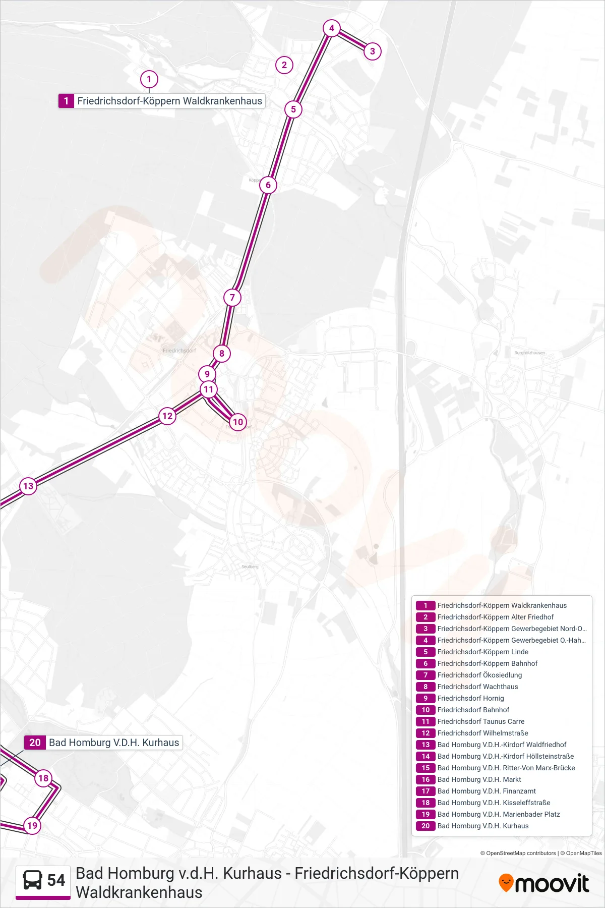
Stops list (54 - Bad Homburg V.D.H. Kurhaus)
- Friedrichsdorf-Köppern Waldkrankenhaus
- Friedrichsdorf-Köppern Alter Friedhof
- Friedrichsdorf-Köppern Gewerbegebiet Nord-Ost
- Friedrichsdorf-Köppern Gewerbegebiet O.-Hahn-Str.
- Friedrichsdorf-Köppern Linde
- Friedrichsdorf-Köppern Bahnhof
- Friedrichsdorf Ökosiedlung
- Friedrichsdorf Wachthaus
- Friedrichsdorf Hornig
- Friedrichsdorf Bahnhof
- Friedrichsdorf Taunus Carre
- Friedrichsdorf Wilhelmstraße
- Bad Homburg V.D.H.-Kirdorf Waldfriedhof
- Bad Homburg V.D.H.-Kirdorf Höllsteinstraße
- Bad Homburg V.D.H. Ritter-Von Marx-Brücke
- Bad Homburg V.D.H. Markt
- Bad Homburg V.D.H. Finanzamt
- Bad Homburg V.D.H. Kisseleffstraße
- Bad Homburg V.D.H. Marienbader Platz
- Bad Homburg V.D.H. Kurhaus
Change direction
- Route Map - 54 - Friedrichsdorf-Köppern Linde
- Route Map - 54 - Friedrichsdorf-Köppern Linde
- Route Map - 54 - Friedrichsdorf Bahnhof
- Route Map - 54 - Friedrichsdorf-Köppern Gewerbegebiet O.-Hahn-Str.
- Route Map - 54 - Friedrichsdorf-Köppern Alter Friedhof
- Route Map - 54 - Friedrichsdorf-Köppern Gewerbegebiet Nord-Ost
- Route Map - 54 - Friedrichsdorf-Köppern Waldkrankenhaus